Wp/iba/Johor Bahru
Appearance
Johor Bahru | |
|---|---|
| City of Johor Bahru Bandaraya Johor Bahru | |
| Other transcription(s) | |
| • Jawi | جوهر بهارو |
| • China | 新山 (Simplified) 新山 (Traditional) Xīnshān (Hanyu Pinyin) |
| • Tamil | ஜொகூர் பாரு Jokūr Pāru (Transliteration) |
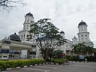
From top, left to right: Downtown skyline at night, Johor-Singapore Causeway and Johor Bahru Sentral the transport hub in Southern Integrated Gateway, Skyline of the city centre, Forest City (Hutan Bandar) Recreational Park, Danga Bay, the Sultan Ibrahim Building, the Sultan Abu Bakar Mosque, and the Figure Museum | |
| Nickname(s): JB, Bandaraya Selatan (Southern City) | |
Location of Johor Bahru in Johor | |
| Lua error in Module:Wp/iba/Location_map at line 524: Unable to find the specified location map definition: "Module:Wp/iba/Location map/data/Malaysia Johor" does not exist. | |
| Coordinates: 01°27′20″N 103°45′40″E / 1.45556°N 103.76111°E | |
| Country | |
| State | Template:Wp/iba/Country data Johor |
| District | Template:Wp/iba/Country data Johor BahruJohor Bahru |
| Administrative areas | List |
| Founded | 10 March 1855 (as Tanjung Puteri) |
| Establishment of the local government | 1933 |
| Establishment of the Town Board | 1950 |
| Municipality status | 1 April 1977 |
| City status | 1 January 1994 |
| Government | |
| • Type | City council |
| • Body | Johor Bahru City Council |
| • Mayor | Noorazam Osman |
| Pemesai | |
| • Penyampau | 391.25 km2 (151.06 sq mi) |
| Elevation | 32 m (105 ft) |
| Penyampau mensia (2020)[3] | |
| • Penyampau | 858,118 |
| • Pemadat | 2,192/km2 (5,680/sq mi) |
| Demonym | Johor Bahru |
| Time zone | UTC+8 (MST) |
| • Summer (DST) | UTC+8 (Not observed) |
| Postal code | 80xxx to 81xxx |
| Area code(s) | 07 |
| Vehicle registration | J |
| Website | www |
Johor Bahru (Malaysian: [ˈdʒohor ˈbahru]), suah dikelala enggau pemandak JB, nyadi mengeri teras Pelilih Menua Johor Bahru, enggau indu nengeri Johor, Malaysia (pelilih menua kedua pemadu besai di menua tu, nitihka penyampau tubuh).[4] Iya nyadi penyaup GDP nasional kedua pemadu besai entara mengeri besai di Malaysia,[5] lalu nyadi sebagi ari Iskandar Malaysia, zon ekonomi khas pemadu besai di menua tu, nitihka rega beranakka puku.[6] Mengeri tu ngembuan penyampau tubuh 858,118 iku enggau pemesai 391.25 km2.
Malin
- ↑ Cite error: Invalid
<ref>tag; no text was provided for refs namedtotal area - ↑ "Malaysia Elevation Map (Elevation of Johor Bahru)". Flood Map : Water Level Elevation Map. Diarkib ari asal on 22 August 2015. Diambi 22 August 2015.
- ↑ "Total population by ethnic group, Local Authority area and state, Malaysia" (PDF). Statistics Department, Malaysia. 2010. Diarkib ari asal (PDF) on 14 November 2013. Diambi 12 March 2012.
- ↑ "DOSM: Petaling district has highest population, density in 2023". www.thesundaily.my. Diambi 2023-10-25.
- ↑ "Achieving A System of Competitive Cities in Malaysia: Main Report" (PDF). World Bank Group & Khazanah Nasional. November 2015.
- ↑ Lee, Shaun (14 January 2019). "An international metropolis 13 years in the making". DHL Logistics of Things. Diambi 2023-10-27.
Categories:
- Artikels with short description
- Short description with empty Wikidata description
- Articles containing Melayu (jaku makro)-language text
- Articles containing Chinese-language text
- Articles containing Tamil-language text
- Pages using multiple image with auto scaled images
- Pages using infobox settlement with possible nickname list
- Coordinates not on Wikidata
- Flagicons with missing country data templates
- Pages with Malaysian IPA
- Wp/iba


