
Wp/sty/Төнйаҡ Асия
.svg)
Төнйаҡ Асия Асияның субрегионы. Урал таулартан суң усып пашланаты. Төнйаҡтан - Төнйаҡ тинкес, көнҡуныш йаҡтан - Ненец аптаном округ, Коми Республика, Пермский край та Пашҡорт Асия, көнйаҡтан - Урта Асия, көнцығыш йаҡтан - Тыныц тинкес та Аляска. 13 100 000 км2 площадь урын алаты, йә 8,8% йерне, йә Бразилиятан 1,5'ҡа рәт оллораҡ. Площадьтан ҡарағанта ул Асияның иң олло субрегионы, йәшәүтән - ас ҡалыҡлы, ҡалыҡ исәплек 33 миллион кеше йә 0.74% ҡалыҡ.
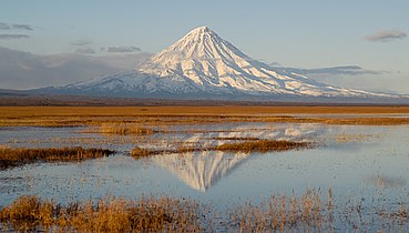
Topographically, the region is dominated by the Eurasian Plate, except for its eastern part, which lies on the North American, Amurian and Okhotsk Plates. It is divided by three major plains: the West Siberian Plain, Central Siberian Plateau and Verhoyansk-Chukotka collision zone. The Uralian orogeny in the west raised Ural Mountains, the informal boundary between Europe and Asia. Tectonic and volcanic activities are frequently occurred in the eastern part of the region as part of the Ring of Fire, evidenced by the formation of island arc such as Kuril Islands and ultra-prominent peaks such as Klyuchevskaya Sopka, Kronotsky and Koryaksky. The central part of North Asia is a large igneous province called the Siberian Traps, formed by a massive eruption occurred 250 million years ago.
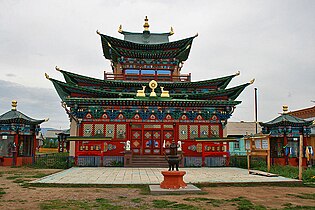
European influences, especially Russian, are strong in the southwestern and central part of the region, due to its high Russian population from Eastern Europe which began to settle the area in the 18th-century CE.[1] The southeastern part is historically under the influence of East Asian cultural sphere, especially the Chinese.[2] Indigenous cultures are mostly strong in the eastern and southern part of the region due to concentrated population of indigenous ethnicities.[3][4] In recent years there are growing number of movements by the indigenous peoples of the region to preserve its culture from extinction.[5][6] The region is the home of different peoples such as Turkic, Tungusic and Uralic peoples.
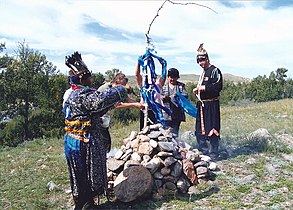
History
[edit | edit source]_(14781887444).jpg)
The region was first populated by hominins in the Late Pleistocene, approximately 50,000 years ago,[7] with the first humans arriving in the region having West Eurasian origins.[8] Its Neolithic culture is characterized by characteristic stone production techniques and the presence of pottery of eastern origin.[8] The Bronze Age began during the 3rd millennium BCE,[9] with influences of Indo-Iranian cultures as evidenced by the Andronovo culture. During the 1st millennium BCE, polities such as the Scythians and Xiongnus emerged in the region, who often clashed with its Persian and Chinese neighbors in the south. The Turkic Khaganate dominated southern Siberia during the 1st millennium CE, while in the early 2nd millennium CE, the Mongol Empire and its successor states ruled the region. The Khanate of Sibir was one of the last independent Turkic states in North Asia before its conquest by the Tsardom of Russia in the 16th century CE. Russia would then gradually incorporate the region into its territory until the Convention of Peking was signed in 1860. After the October Revolution in 1917, the region was contested between the Bolsheviks and Whites until the Soviet Union asserted full control in 1923. The collapse of the Soviet Union in 1991 left Russia as the administrator of the region.
Geography
[edit | edit source]Template:Wp/sty/Further For geographic and statistical reasons, the UN geoscheme and various other classification schemes will not subdivide countries, and thus place all of Russia in the Europe or Eastern Europe subregion.
There are no mountain chains in Northern Asia to prevent air currents from the Arctic flowing down over the plains of Siberia and Turkestan.[10]
The plateau and plains of Northern Asia comprise the West Siberian lowlands; the Angara Shield, with the Taimyr Peninsula, the coastal lowlands, the Putorana Plateau, the Anabar Plateau, the Tunguska Plateau, and the Angara Plateau; and the Lena–Vilyuy Basin.[11] Western Siberia is usually regarded as the Northwest Asia, Kazakhstan also sometimes included there. But Northwest Asia sometimes refers to Caucasus or nearby provinces.
Geomorphology
[edit | edit source]Template:Wp/sty/Further The geomorphology of Asia in general is imperfectly known, although the deposits and mountain ranges are well known.[11]
To compensate for new sea floor having been created in the Siberian basin, the whole of the Asian Plate has pivoted about a point in the New Siberian Islands, causing compression in the Verkhoyansk mountains, which were formed along the eastern margin of the Angara Shield by tectonic uplift during the Mesozoic Era. There is a southern boundary to this across the northern margin of the Alpine folds of Afghanistan, India, Nepal, and Bhutan, which at the east of Brahmaputra turns to run south towards the Bay of Bengal along the line of the Naga hills and the Arakan Yoma, continues around Indonesia, and follows the edge of the continental shelf along the eastern seaboard of China. The Eurasian Plate and the North American Plate meet across the neck of Alaska, following the line of the Aleutian Trench, rather than meeting at the Bering Straits.[11]
Northern Asia is built around the Angara Shield, which lies between the Yenisey River and the Lena River. It developed from fragments of Laurasia, whose rocks were mainly Precambrian crystalline rocks, gneisses, and schists, and Gondwana. These rocks can be found in the Angara Shield, the Inner Mongolian-Korean Shield, the Ordes Shield and the Southeast Asia Shield. The fragments have been subject to orogenesis around their margins, giving a complex of plateaux and mountain ranges. One can find outcrops of these rocks in unfolded sections of the Shields. Their presence has been confirmed below Mesozoic and later sediments.[11]
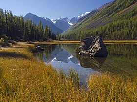
There are three main periods of mountain building in Northern Asia, although it has occurred many times. The outer fold mountains, that are on the margins of the Shields and that only affected Asia north of the line of the Himalayas, are attributed to the Caledonian and Hercynian orogenies of the late Palaeozoic Era. The Alpine orogeny caused extensive folding and faulting of Mesozoic and early Tertiary sediments from the Tethys geosyncline. The Tibetan and Mongolian plateaux, and the structural basins of Tarim, Qaidam, and Junggar, are delimited by major east-west lithospheric faults that were probably the results of stresses caused by the impact of the Indian Plate against Laurasia. Erosion of the mountains caused by this orogeny has created a large amount of sediment, which has been transported southwards to produce the alluvial plains of India, China, and Cambodia, and which has also been deposited in large amounts in the Tarim and Dzungarian basins.[11]
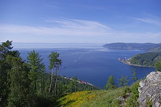
Template:Wp/sty/Physical map of Siberia Northern Asia was glaciated in the Pleistocene, but this played a less significant part in the geology of the area compared to the part that it played in North America and Europe. The Scandinavian ice sheet extended to the east of the Urals, covering the northern two thirds of the Ob Basin and extending onto the Angara Shield between the Yenisei River and the Lena River. There are legacies of mountain glaciation to be found on the east Siberian mountains, on the mountains of the Kamchatka Peninsula, on the Altai, on Tian Shan, and on other small areas of mountains, ice caps remain on the islands of Severnaya Zemlya and Novaya Zemlya, and several Central Asian mountains still have individual glaciers. North Asia itself has permafrost, ranging in depths from 30 to 600 metres and covering an area of 9.6 million km².[11]
Several of the mountainous regions are volcanic, with both the Koryak Mountains and the Kamchatka Peninsula having active volcanoes. The Anadyr Plateau is formed from igneous rocks. The Mongolian Plateau has an area of basaltic lavas and volcanic cones.[11]
The Angara Shield also underlies the lowlands of the Ob River, but to the south and east in the Central Asian mountains and in the East Siberian mountains there are folded and faulted mountains of Lower Palaeozoic rocks.[11]
Demographics
[edit | edit source]Template:Wp/sty/Further Most estimates are that there are around 33 million Russian citizens living east of the Ural Mountains, a widely recognized but informal geographical divide between Europe and Asia. The native Turkic, Uralic and Tungusic peoples now are a minority in North Asia due to the Russification process during the last three centuries. Russian census records indicate they make up only an estimated 10% of the region's population with the Buryats numbering at 445,175, which makes them the largest ethnic minority group in Siberia. There are 443,852 Yakuts (Russian Census of 2002) living in Russian Far East.[12] According to the 2002 census, there are 500,000 Tatars in Siberia, but 300,000 of them are Volga Tatars who settled in Siberia during periods of colonization.[13] Other ethnic groups that live in the region and make a significant portion are ethnic Germans and they number about 400,000.
In 1875, Chambers reported the population of Northern Asia to be 8 million.[10] Between 1801 and 1914, an estimated 7 million settlers moved from European Russia to Siberia, 85% during the quarter-century before World War I.[14]
Urban centres
[edit | edit source]Template:Wp/sty/Largest cities of North Asia
Gallery
[edit | edit source]-
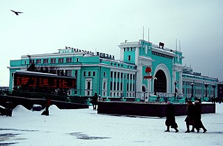
 Center of Vladivostok
 -
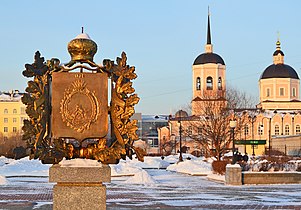 Lenin Square, Tomsk
 -

-
-
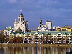 Yekaterinburg riverside
 -

-

-

-
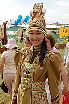 Yakut woman in traditional dress, Sakha Republic
 -
-
-
-

-
-


-2.jpg)
.jpg)


.jpg)
Алай уҡ ҡараң
[edit | edit source]Template:Wp/sty/Portal Template:Wp/sty/Commons
- Arctic Region
- Far North
- Siberia
- Асия
- Асияның йерйасымы
- Northeast Asia
- Рәсәй
- Siberian High, a semipermament anticyclone
References
[edit | edit source]- ↑ Template:Wp/sty/Cite book
- ↑ Template:Wp/sty/Cite book
- ↑ Template:Wp/sty/Cite book
- ↑ Template:Wp/sty/Cite book
- ↑ Template:Wp/sty/Cite book
- ↑ Template:Wp/sty/Cite book
- ↑ Template:Wp/sty/Cite web
- ↑ 8.0 8.1 Template:Wp/sty/Cite journal
- ↑ Template:Wp/sty/Cite journal
- ↑ 10.0 10.1 Template:Wp/sty/Cite book
- ↑ 11.0 11.1 11.2 11.3 11.4 11.5 11.6 11.7 Template:Wp/sty/Cite book
- ↑ Siberian Germans
- ↑ Siberian Tatars
- ↑ The Great Siberian Migration: Government and Peasant in Resettlement from Emancipation to the First World War
Template:Wp/sty/Regions of the world Template:Wp/sty/Asia topics Template:Wp/sty/Countries of Asia Template:Wp/sty/Russia topics