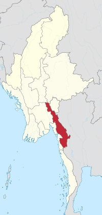
Wp/ksw/ကညီကီၢ်စဲၣ်
| ကညီကီၢ်စဲၣ် | |
|---|---|
| ကီၢ်စဲၣ် | |
| ကရင်ပြည်နယ် | |
 ကညီကီၢ်စဲၣ်ဟီၣ်ခိၣ်ဂီၤ | |
| ကိၣ်ဒံးန့ၣ်: 17°0′N 97°45′E / 17.000°N 97.750°Eကိုဩဒိနိတ်: 17°0′N 97°45′E / 17.000°N 97.750°E | |
| ထံကီၢ် | |
| လီၢ်ကဝီၤ | မုၢ်ထီၣ်ကလံၤထံး |
| ဝ့ၢ်ခိၣ် | ဖၣ်အၣ် |
| ပဒိၣ် | |
| • ကီၢ်စဲၣ်ကိတိာ် | စီၤမၠ့ၣ်အူ |
| • Cabinet | ကညီကီၢ်စဲၣ်ပဒိၣ် |
| • တၢ်ဒုးအိၣ်ထီၣ်တၢ်ဘျၢဝဲၤဒၢး | ကညီကီၢ်စဲၣ်ဘျီၣ်ဒိၣ် |
| • သဲစးဝဲကျိၤ | ကညီကီၢ်စဲၣ်ကွၢ်ဘျီၣ် |
| အ့ရယၢ် | |
| • ပာ်ဖှိၣ်ခဲလၢာ် | ၃၀၃၈၂.၈ စကွဲကံလိမံထၢၣ် (၁၁,၇၃၀.၉ စကွဲမံလး) |
| အ့ရယၢ်အပတီၢ် | 11th |
| ဖးထီ ကတၢၢ် (Nattaung) | ၂၆၂၃ မံထၢၢ် (၈,၆၀၆ မံလာ်) |
| အပှၤနီၣ်ဂံၢ် (2014 တၢ်ထၢထံဖိကီၢ်ဖိနီၢ်ဂံၢ်စရီ)[1] | |
| • ပာ်ဖှိၣ်ခဲလၢာ် | ၁,၅၇၄,၀၇၉ |
| • အပတီၢ် | 11th |
| ကမျၢၢ်အမံၤ | ကညီ |
| ပှၤကလုာ်တၢ်အိၣ်သး | |
| • ကလုာ်ဒူၣ်တဖၣ် | ကညီ (အါလီၤကတၢၢ်), ကယါန်, ပယီၤ, ယိၤဒိၣ်, ပအိၣ်, တလၢၤ, ရခၢၣ်, |
| • တၢ်ဘူၣ်တၢ်ဘါ | ပှၤဘူးဒးဖိ 84.50% ပှၤခရံာ်ဖိ 9.50% ပှၤအံးစလၣ်ဖိ 4.60% ပှၤဟ့ၣ်ဒူၢ်ဖိ 0.60% Animism 0.10% ပှၤဘါတၢ်ဘါအဂၤတဖၣ် 0.70% |
| တၢ်ဆၢကတီၢ်နီၣ်ထိၣ် | MMT (UTC+06:30) |
| HDI (2017) | 0.527[2] low · 12th |
| ကျိာ်လၢအဖိးသဲစး | ကညီ |
| ဝဲၣ်ဘစဲၣ် | kayinstate.gov.mm |
ကညီကီၢ်စဲၣ် (မုၢ်ထီၣ်ပှိၢ်:ဖၠုံခါန်ႋကၞင့်, ပယီၤ:ကရင်ပြည်နယ်) မ့ၢ် ကီၢ်ပယီၤ တၢ်ပၢတၢ်ဆှၢကီၣ်စဲၣ်တဘ့ၣ်န့ၣ်လီၤ. အဝ့ၢ်ခိၣ်မ့ၢ်ဝဲ ဖၣ်အၣ်န့ၣ်လီၤ.
ကညီကီၢ်စဲၣ်အံၤအိၣ်ဒီး ဒီနးကစၢၢ် လၢကီၢ်စဲၣ်မ NNW - SSE တကပၤ ဒီး ကညီကစၢၢ် လၢကလံၤစိးမုၢ်နုာ်တပၤန့ၣ်လီၤ. [3] လၢမုၢ်ထီၣ်တကပၤန့ၣ် ကီၢ်စဲၣ်အဆၢဒီး ကီၢ်ကၠီၣ်တဲၣ် အကီၢ်ရ့ၣ် မဲဟီင်ဆီး, ထၣ်, ဒီး ခၣ်ခၠါနါဘူရံ တဖၣ်န့ၣ်လီၤ. တလၢၤကီၢ်ဒဲၣ် ဒီး ပကိကီၢ်ခီဒိ အိၣ်လၢ မၢ်နုာ်ဒီးကလံၤထံးတပၤန့ၣ်လီၤ. မ့မ့ၢ်လၢ မါဒလ့ကီၢ်ခီဒိၣ်, ယိၤဒိၣ်ကီၢ်စဲၣ် ဒီး ကရ့ၣ်နံၣ်ကီၢ်စဲၣ်တခီ အိၣ်လၢကညီကီၢ်စဲၣ်ဖၢခိၣ်န့ၣ်လီၤ.
ပဒိၣ်
[edit | edit source]ကညီကီၢ်စဲၣ်ပဒိၣ်ခၠဲးဖးအသး (3) ဒ့: ပှၤအခိၣ်, တၢ်ဒုးအိၣ်ထီၣ်တၢ်ဘျၢဝဲၤဒၢး (ကညီကီၢ်စဲၣ်ဘျီၣ်ဒိၣ်), ဒီး တၢ်စံၣ်ညီၣ်ကွၢ်တၢ် (ကညီကီၢ်စဲၣ်ကွီၢ်ဘျီၣ်ထီကတၢၢ်) န့ၣ်လီၤ.
တၢ်ပၢတၢ်ဆှၢလီၢ်ကဝီၤ
[edit | edit source]ကညီကီၢ်စဲၣ်အိၣ်ဝဲဒီး ဝ့ၢ်တဖျၢၣ်ဒီး ဝ့ၢ်ဖိခွံဖျၢၣ်န့းလီၤ. အကီၢ်ရ့ၣ်ဖိအိၣ်ဝဲလွံၢ်က့, ကီၢ်ဆၣ်နွံက့ ဒီး သဝီအိၣ်ရဝဲ 4092 ဖျၢၣ်န့ၣ်လီၤ.

ကီၢ်ရ့ၣ်ဖိ
[edit | edit source]ကီၢ်ဆၣ်
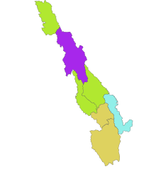
[edit | edit source]- ဖၣ်အၣ်ကီၢ်ဆၣ်
- လဘွဲကီဆၣ်
- ဖၣ်ပူၣ်ကီၣ်ဆၣ်
- သါတီကၠံၤကီၢ်ဆၣ်
- မၠၣ်ဝတံၤကီၢ်ဆၣ်
- ကီၢ်တရံးကီၢ်ဆၣ်
- ကၠၤအံစ့ၣ်ကၠံၤကီၢ်ဆၣ်
ဝ့ၢ်ဒီးဝ့ၢ်ဖိတဖၣ်
[edit | edit source]အပှၤနီၣ်ဂံၢ်
[edit | edit source]| Year | Pop. | ±% |
|---|---|---|
| 1973 | 858,429 | — |
| 1983 | 1,055,359 | +22.9% |
| 2014 | 1,574,079 | +49.2% |
| Source: 2014 Myanmar Census[1] | ||
လံာ်ကွၢ်သတြဲၤ
[edit | edit source]- ↑ 1.0 1.1 Census Report. The 2014 Myanmar Population and Housing Census. 2. Naypyitaw: Ministry of Immigration and Population. May 2015. p. 17.
- ↑ Sub-national HDI - Area Database - Global Data Lab (in en)။
- ↑ The Physical Geography of Southeast Asia, Avijit Gupta, Oxford University Press, 2005. [[Template:Wp/ksw/|Template:Wp/ksw/]] 978-0-19-924802-5Template:Wp/ksw/


