
File:USA North Carolina physical map.jpg
Size of this preview: 800 × 412 pixels. Other resolutions: 320 × 165 pixels | 640 × 329 pixels | 1,024 × 527 pixels | 1,756 × 904 pixels.
Original file (1,756 × 904 pixels, file size: 645 KB, MIME type: image/jpeg)
Summary
| Description | |
| Date | |
| Source |
Own work
|
| Author | Alexrk2 |

|
This map has been made or improved in the German Kartenwerkstatt (Map Lab). You can propose maps to improve as well.
|
Licensing
I, the copyright holder of this work, hereby publish it under the following license:
This file is licensed under the Creative Commons Attribution 3.0 Unported license.
- You are free:
- to share – to copy, distribute and transmit the work
- to remix – to adapt the work
- Under the following conditions:
- attribution – You must give appropriate credit, provide a link to the license, and indicate if changes were made. You may do so in any reasonable manner, but not in any way that suggests the licensor endorses you or your use.
File history
Click on a date/time to view the file as it appeared at that time.
| Date/Time | Thumbnail | Dimensions | User | Comment | |
|---|---|---|---|---|---|
| current | 13:36, 25 April 2010 | | 1,756 × 904 (645 KB) | Alexrk2 | typo |
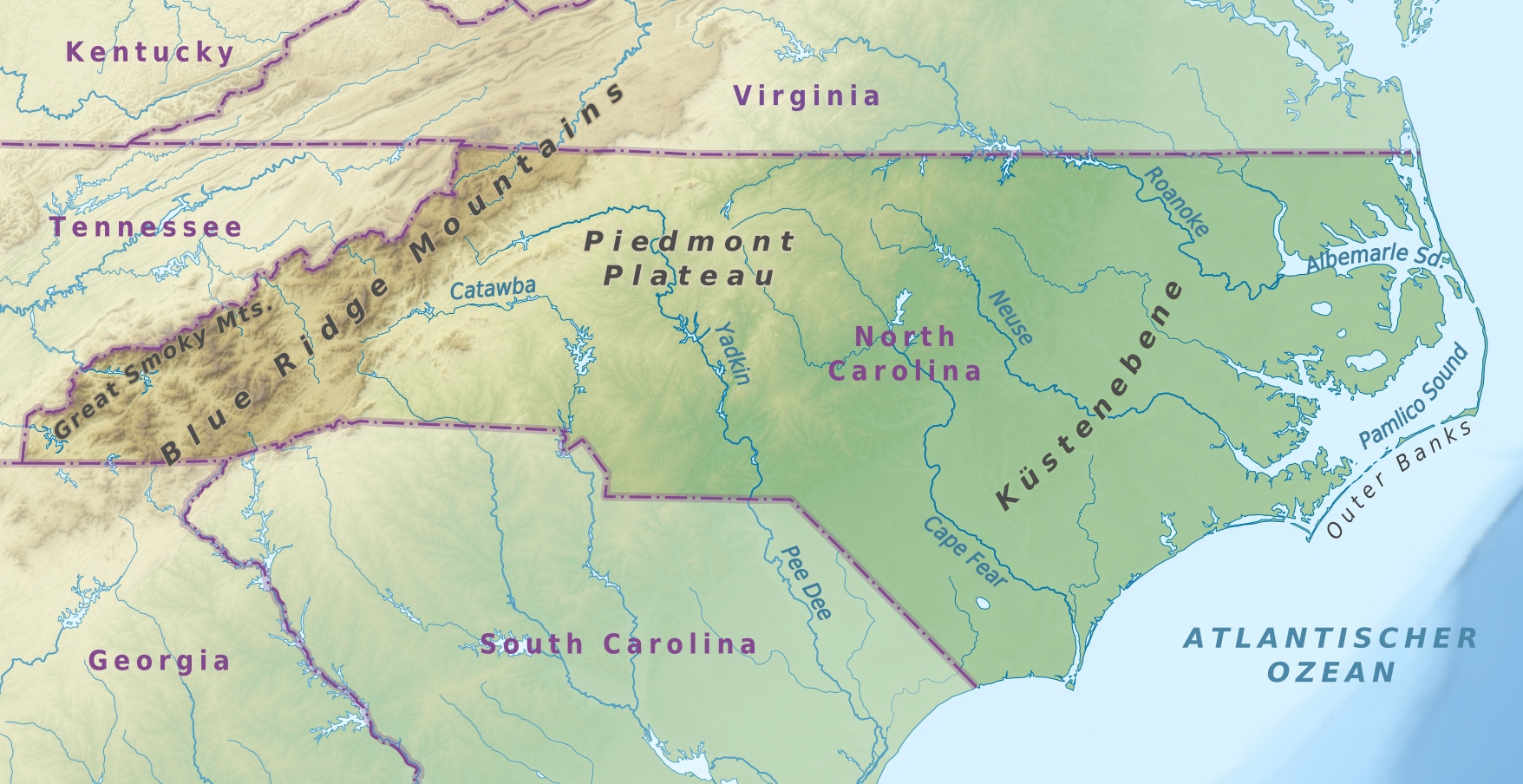
| 12:19, 25 April 2010 |  | 1,756 × 904 (645 KB) | Alexrk2 | {{Information |Description={{de|Physische Karte von North Carolina, USA}} {{en|Physical map of North Carolina, USA}} |Source={{Own}} * Data from http://naturalearthdata.com/, Scale: 1:5 |
File usage
The following page uses this file:
Global file usage
The following other wikis use this file:
- Usage on de.wikipedia.org
- Usage on hu.wikipedia.org
- Usage on pl.wikipedia.org