
File:Relief Map of North Ossetia.png

Size of this preview: 550 × 599 pixels. Other resolutions: 220 × 240 pixels | 441 × 480 pixels | 1,000 × 1,089 pixels.
Original file (1,000 × 1,089 pixels, file size: 1.66 MB, MIME type: image/png)
Summary
| Description |
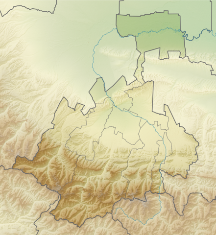
Русский: Физическая карта Республики Северная Осетия-Алания Равноугольная проекция. Координаты краёв:
|
| Date | |
| Source | |
| Author | Виктор В |
| Other versions |
[] |


Licensing
| I, the copyright holder of this work, release this work into the public domain. This applies worldwide. In some countries this may not be legally possible; if so: I grant anyone the right to use this work for any purpose, without any conditions, unless such conditions are required by law. |
File history
Click on a date/time to view the file as it appeared at that time.
| Date/Time | Thumbnail | Dimensions | User | Comment | |
|---|---|---|---|---|---|
| current | 16:30, 16 August 2010 | | 1,000 × 1,089 (1.66 MB) | Виктор В | == {{int:filedesc}} == {{Information |Description={{ru|1=Физическая карта Республики Северная Осетия-Алания<br\>Равноугольная проекция. Координаты краёв: * север — 43. |
File usage
There are no pages that use this file.
Global file usage
The following other wikis use this file:
- Usage on ba.wikipedia.org
- Usage on be.wikipedia.org
- Usage on bg.wikipedia.org
- Usage on ce.wikipedia.org
- Usage on cs.wikipedia.org
- Usage on da.wikipedia.org
- Usage on de.wikipedia.org
- Usage on eo.wikipedia.org
- Beslano
- Ŝablono:Geokesto lokumilo Nord-Osetio
- Ŝablono:Situo sur mapo Ruslando Nord-Osetio
- Sunaisma moskeo de Vladikavkaz
- Ĉeurba distrikto (Nord-Osetio)
- Distrikto Alagir
- Distrikto Ardon
- Distrikto Digora
- Distrikto Iraf
- Distrikto Kirov (Nord-Osetio)
- Distrikto Mozdok
- Dekstraborda distrikto (Nord-Osetio)
- Usage on es.wikipedia.org
- Usage on fi.wikipedia.org
- Usage on frr.wikipedia.org
- Usage on fr.wikipedia.org
View more global usage of this file.