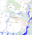
File:Karte Berlin Landnutzung.png
Appearance

Size of this preview: 745 × 599 pixels. Other resolutions: 298 × 240 pixels | 597 × 480 pixels | 955 × 768 pixels | 1,273 × 1,024 pixels | 2,546 × 2,048 pixels | 10,361 × 8,336 pixels.
Original file (10,361 × 8,336 pixels, file size: 21.98 MB, MIME type: image/png)
File history
Click on a date/time to view the file as it appeared at that time.
| Date/Time | Thumbnail | Dimensions | User | Comment | |
|---|---|---|---|---|---|
| current | 19:15, 31 August 2014 |  | 10,361 × 8,336 (21.98 MB) | Chumwa | == {{int:filedesc}} == {{Information |Description = {{de|1=Karte Landnutzung Berlin}} |Source={{own}} using OpenStreetMap rendered with [http://maperitive.net/ Maperitive] |Date = see file history |Author = [[:de:User:Chumwa|Maxi... |
File usage
The following page uses this file:
Global file usage
The following other wikis use this file:
- Usage on ang.wikipedia.org
- Usage on ca.wikipedia.org
- Usage on de.wikipedia.org
- Usage on eo.wikipedia.org
- Usage on ga.wikipedia.org
- Usage on gl.wikipedia.org
- Usage on tt.wikipedia.org
- Usage on www.wikidata.org


