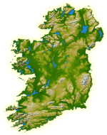
File:Ireland geographical map.png
Appearance
Ireland_geographical_map.png (150 × 190 pixels, file size: 50 KB, MIME type: image/png)
File history
Click on a date/time to view the file as it appeared at that time.
| Date/Time | Thumbnail | Dimensions | User | Comment | |
|---|---|---|---|---|---|
| current | 11:39, 11 July 2005 |  | 150 × 190 (50 KB) | Kanchelskis | Map of Ireland lightened. Author:me {{GFDL}} Category: Ireland |
File usage
There are no pages that use this file.
Global file usage
The following other wikis use this file:
- Usage on bew.wikipedia.org
- Usage on de.wikipedia.org
- Usage on en.wikipedia.org
- User:Jtdirl
- User:Kwekubo
- Dingle Peninsula
- User:Zoney
- Iveragh Peninsula
- User:Ropers
- User:Gerry Lynch
- User:AndrewH
- User:Ebelular
- Inishowen
- User:Fergananim
- Mizen Head
- Sheep's Head
- Old Head of Kinsale
- User:Rye 212
- Ards Peninsula
- User:Blorg
- User:Wexfordman
- User:Meabhar~enwiki
- Howth Head
- User:Sean3000
- User:Notjim
- User:Jasonm
- User:Kgaughan
- Beara Peninsula
- User:John Carroll
- User:Bjimba
- User talk:Lochaber
- Fanad
- User:Hetch
- Islandmagee
- User:Wikipedian231
- User:Jdorney
- User:Merlante
- User:Lugnad
- Slieve League
- User:Ben-w
- Hook Peninsula
- User:Polar ice
- User:Dowlingm
- User:Frure
- User:Ventolin
- User:Dkie
- User:Colm Rice
- Mullaghmore, County Sligo
- User:Damac
- User:Ian Cheese
- User:Tpower
View more global usage of this file.


