
File:Guiana shield map-fr.svg

Size of this PNG preview of this SVG file: 742 × 599 pixels. Other resolutions: 297 × 240 pixels | 594 × 480 pixels | 951 × 768 pixels | 1,268 × 1,024 pixels | 2,535 × 2,048 pixels | 3,123 × 2,523 pixels.
Original file (SVG file, nominally 3,123 × 2,523 pixels, file size: 1.03 MB)
Summary
| Description |
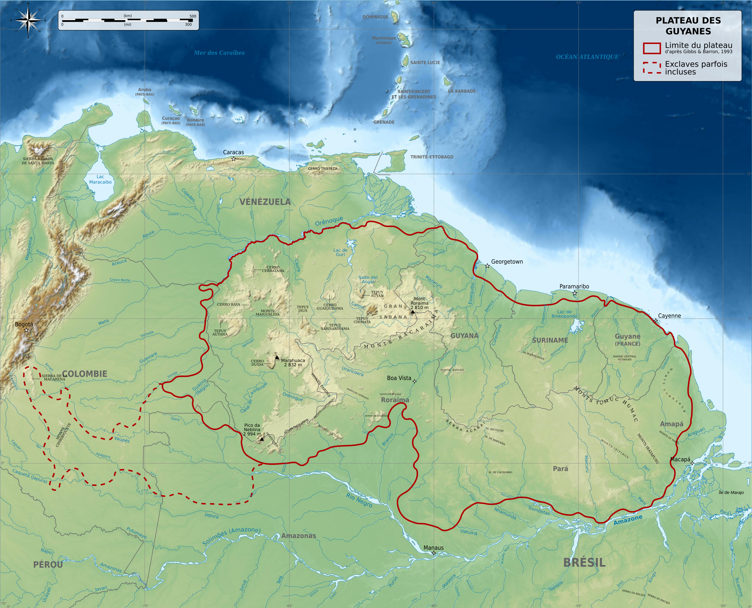
English: Physical map of Guiana Shield, a craton located in South America, between Brazil, French Guiana, Suriname, Guyana, Venezuela and Colombia. Français : Carte physique du plateau des Guyanes, un craton situé en Amérique du Sud, répartis entre le Brésil, la Guyane française, le Suriname, le Guyana, le Vénézuela et la Colombie. Македонски: Карта на Гвајанскиот Штит во Јужна Америка. |
||
| Date | |||
| Source |
Own work. Source :
Additional data :
|
||
| Author | Sémhur (talk) | ||
| Other versions |
Derivative works of this file: | ||
| Attribution (required by the license) | © Sémhur / Wikimedia Commons / | ||
| SVG | W3C-validity not checked.
|
||
| Graphic Lab |


-es.svg)
-es.svg)
| Camera location | | View this and other nearby images on: OpenStreetMap |
|---|
Licensing
I, the copyright holder of this work, hereby publish it under the following licenses:
| Copyleft: This work of art is free; you can redistribute it and/or modify it according to terms of the Free Art License. You will find a specimen of this license on the Copyleft Attitude site as well as on other sites. |
This file is licensed under the Creative Commons Attribution-Share Alike 4.0 International, 3.0 Unported, 2.5 Generic, 2.0 Generic and 1.0 Generic license.
- You are free:
- to share – to copy, distribute and transmit the work
- to remix – to adapt the work
- Under the following conditions:
- attribution – You must give appropriate credit, provide a link to the license, and indicate if changes were made. You may do so in any reasonable manner, but not in any way that suggests the licensor endorses you or your use.
- share alike – If you remix, transform, or build upon the material, you must distribute your contributions under the same or compatible license as the original.
You may select the license of your choice.
File history
Click on a date/time to view the file as it appeared at that time.
| Date/Time | Thumbnail | Dimensions | User | Comment | |
|---|---|---|---|---|---|
| current | 06:49, 27 May 2014 | | 3,123 × 2,523 (1.03 MB) | Sémhur | Valid SVG |
| 21:53, 5 December 2010 |  | 3,123 × 2,523 (1.03 MB) | Sémhur | Mispelling : Mer ces Caraïbes => Mer des Caraïbes | |
| 18:57, 3 December 2010 |  | 3,123 × 2,523 (1.03 MB) | Sémhur | With the good size | |
| 18:55, 3 December 2010 |  | 512 × 414 (1.08 MB) | Sémhur | == {{int:filedesc}} == {{Information |Description={{Multilingual description |en= Physical map of Guiana Shield, a craton located in South America, between Brazil, French Guiana, Suriname, Guyana, Venezuela and Colombi |
File usage
There are no pages that use this file.
Global file usage
The following other wikis use this file:
- Usage on es.wikipedia.org
- Usage on fr.wikipedia.org
- Usage on gcr.wikipedia.org
- Usage on it.wikipedia.org
- Usage on ky.wikipedia.org
- Usage on mn.wikipedia.org
- Usage on nl.wikipedia.org
- Usage on oc.wiktionary.org