
File:Carte du Léman (avec ses subdivisions).png
Size of this preview: 800 × 454 pixels. Other resolutions: 320 × 182 pixels | 640 × 363 pixels | 1,024 × 581 pixels | 1,800 × 1,021 pixels.
Original file (1,800 × 1,021 pixels, file size: 251 KB, MIME type: image/png)
| Description |
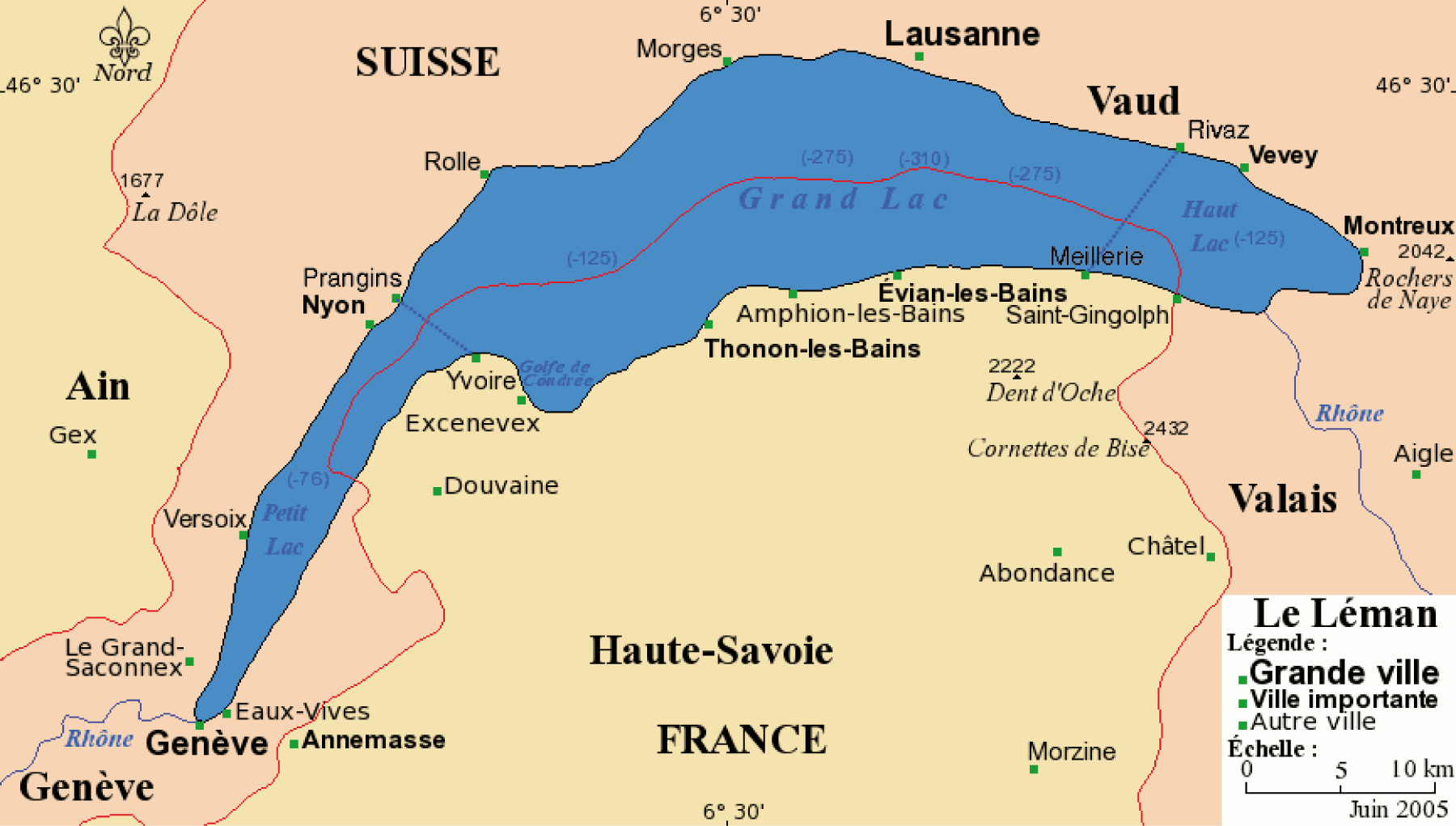
Français : Carte du Léman avec ses villes principales. Projection de Mercator Fond de carte provenant de www.aquarius.geomar.de. |
||||||||
| Date | |||||||||
| Source | Bra, derivative work by Maximilian Dörrbecker (Chumwa) | ||||||||
| Author |
Own work Chumwa |
||||||||
| Permission (Reusing this file) |
|
||||||||
| Other versions |
 original work by Bra ; original work by Bra ;    |

.png)
File history
Click on a date/time to view the file as it appeared at that time.
| Date/Time | Thumbnail | Dimensions | User | Comment | |
|---|---|---|---|---|---|
| current | 09:18, 6 March 2011 | | 1,800 × 1,021 (251 KB) | Chumwa | {{Information |Description={{ fr }}Carte du Léman avec ses villes principales. Projection de Mercator ''Fond de carte provenant de [http://www.aquarius.geomar.de www.aquarius.geomar.de]. |Source=Bra, derivative work by [[:de:User:Chumwa|Max |
File usage
The following page uses this file:
Global file usage
The following other wikis use this file:
- Usage on br.wikipedia.org
- Usage on bs.wikipedia.org
- Usage on ca.wikipedia.org
- Usage on cy.wikipedia.org
- Usage on de.wikipedia.org
- Usage on eo.wikipedia.org
- Usage on es.wikipedia.org
- Usage on fi.wikipedia.org
- Usage on he.wikipedia.org
- Usage on io.wikipedia.org
- Usage on io.wiktionary.org
- Usage on ja.wikipedia.org
- Usage on ko.wikipedia.org
- Usage on pt.wikipedia.org
- Usage on ro.wikipedia.org
- Usage on scn.wikipedia.org
- Usage on vi.wikipedia.org
.png)