
File:Karelija numbered.png
Size of this preview: 400 × 600 pixels. Other resolutions: 160 × 240 pixels | 320 × 480 pixels | 512 × 768 pixels | 683 × 1,024 pixels | 2,000 × 2,998 pixels.
Original file (2,000 × 2,998 pixels, file size: 716 KB, MIME type: image/png)
| Description |
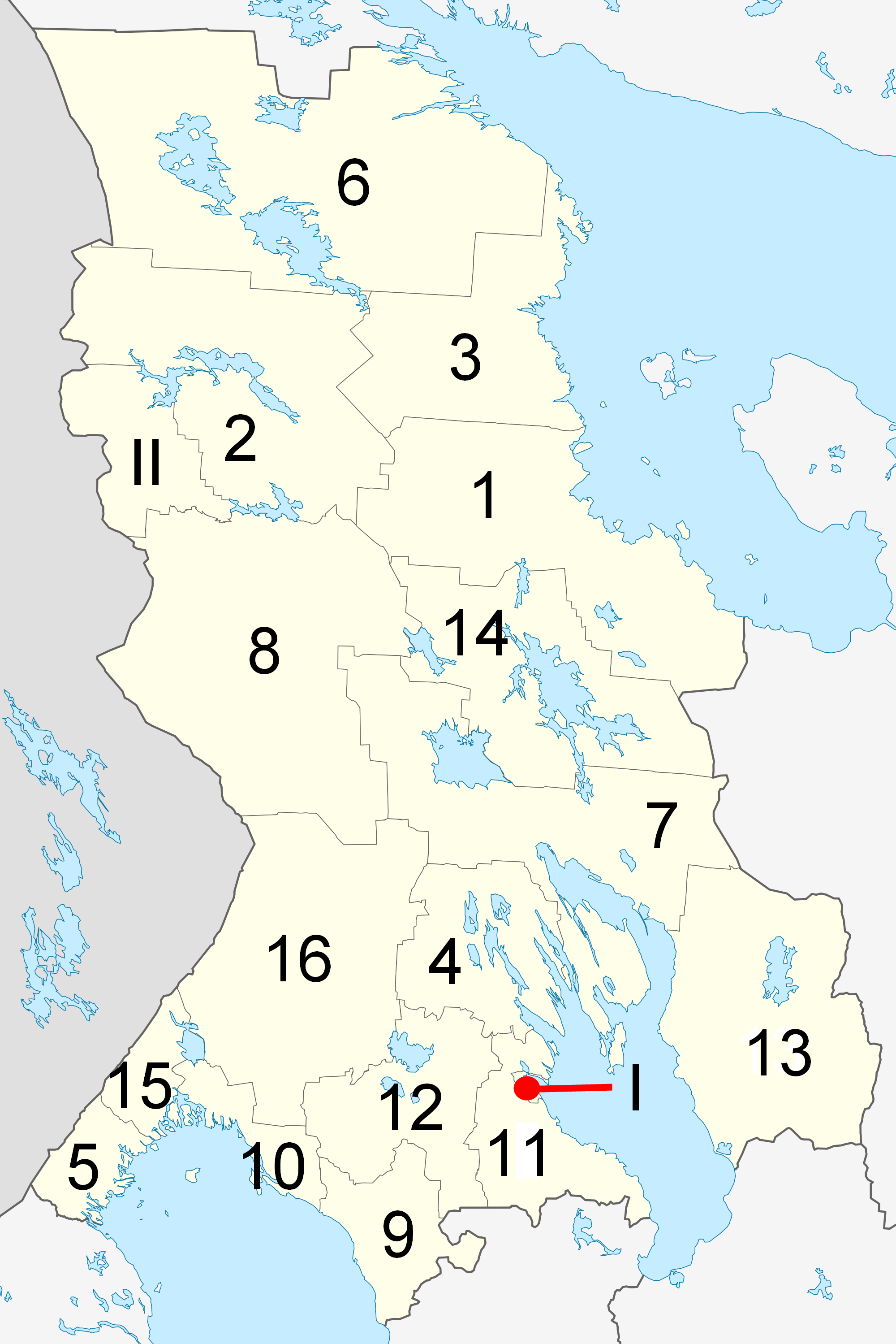
English: Numbered map of Republik Karelija Русский: Карта административно-территориального деления Республики Карелия с цифровыми отметками |
| Date | (UTC) |
| Source | |
| Author |
|
| This is a retouched picture, which means that it has been digitally altered from its original version. Modifications: numbered map. The original can be viewed here: Outline Map of Karelia.svg:
|
I, the copyright holder of this work, hereby publish it under the following license:
| I, the copyright holder of this work, release this work into the public domain. This applies worldwide. In some countries this may not be legally possible; if so: I grant anyone the right to use this work for any purpose, without any conditions, unless such conditions are required by law. |
Original upload log
This image is a derivative work of the following images:
- File:Outline_Map_of_Karelia.svg licensed with PD-self
- 2010-03-19T17:08:37Z Виктор В 1309x1962 (187774 Bytes) == {{int:filedesc}} == {{Information |Description={{ru|1=Позиционная карта Республики КарелияРавноугольная проекция, растяжение — 220%. Координаты к
Uploaded with derivativeFX
File history
Click on a date/time to view the file as it appeared at that time.
| Date/Time | Thumbnail | Dimensions | User | Comment | |
|---|---|---|---|---|---|
| current | 18:56, 19 October 2010 | | 2,000 × 2,998 (716 KB) | Paramecium | {{Information |Description={{en|Numbered map of Republik Karelija |Source=*File:Outline_Map_of_Karelia.svg |Date=2010-10-19 18:55 (UTC) |Author=*File:Outline_Map_of_Karelia.svg: Виктор В *derivative work: ~~~ |P |
File usage
The following page uses this file:
Global file usage
The following other wikis use this file:
- Usage on ba.wikipedia.org
- Usage on be-tarask.wikipedia.org
- Usage on be.wikipedia.org
- Usage on da.wikipedia.org
- Usage on de.wikipedia.org
- Usage on fi.wikipedia.org
- Usage on fr.wikipedia.org
- Usage on lez.wikipedia.org
- Usage on sr.wikipedia.org
- Usage on vep.wikipedia.org