
File:Canada (orthographic projection).svg

Size of this PNG preview of this SVG file: 541 × 541 pixels. Other resolutions: 240 × 240 pixels | 480 × 480 pixels | 768 × 768 pixels | 1,024 × 1,024 pixels | 2,048 × 2,048 pixels.
Original file (SVG file, nominally 541 × 541 pixels, file size: 487 KB)
Summary
| Description |
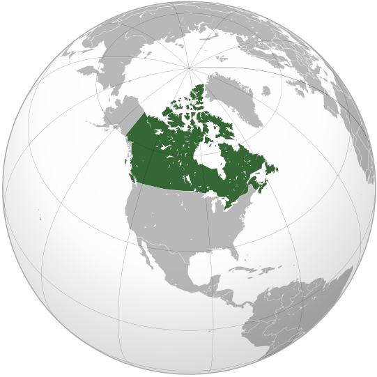
English: Map of Canada |
||||
| Date | |||||
| Source |
Own work (Original text: Own work,)
|
||||
| Author | Ssolbergj | ||||
| Other versions |
Derivative works of this file: Map of New Brunswck.png .svg)
|
||||
| SVG development |

.svg)
.svg)
.svg)
.svg)
.svg)
.svg)
.svg)
.svg)
.svg)
.svg)
.svg)
.svg)
.svg)
.svg)
.svg)
.svg)
.svg)
.svg)
.svg)
.svg)
.svg)
.svg)
.svg)
.svg)
.svg)
.svg)
.svg)
.svg)
.svg)
.svg)
.svg)
.svg)
.svg)
.svg)
.svg)
.svg)
.svg)
.svg)
.svg)
.svg)
.svg)
.svg)
.svg)
.svg)
.svg)
.svg)
.svg)
.svg)
.svg)
.svg)
.svg)
.svg)
.svg)
.svg)
.svg)
.svg)
.svg)
.svg)
.svg)
.svg)
.svg)
.svg)
.svg)
.svg)
.svg)
.svg)
.svg)
.svg)
.svg)
.svg)
.svg)
.svg)
.svg)

.svg)

.svg)

.svg)
.svg)
.svg)
.svg)
.svg)
.svg)
.svg)


.svg)
.svg)
.svg)
.svg)
.svg)
.svg)
.svg)

.svg)
.svg)
.svg)
.svg)
.svg)
.svg)
.svg)
.svg)
.svg)

.svg)
.svg)
.svg)
.svg)
.svg)
.svg)
.svg)
_without_national_boundaries.svg)
.svg)
.svg)
.svg)
.svg)
.svg)
.svg)

.svg)
.svg)
.png)
.svg)
.svg)
.svg)
.svg)

.svg)
.svg)
.svg)
.svg)
.svg)
.svg)
.svg)
.svg)
.svg)
.svg)
.svg)

.svg)
.svg)
.svg)
.svg)
.svg)
.svg)
.svg)
.svg)
.svg)

.svg)
.svg)

.svg)
.svg)
.svg)
.svg)
.svg)
.svg)
.svg)
.svg)
.svg)
.svg)
.svg)
.svg)
.svg)
.svg)
.svg)
.svg)
.svg)
.svg)
.svg)
.svg)
.svg)
.svg)
.svg)
.svg)
.svg)
.svg)
.svg)
_-_Crimea_disputed.svg)
.svg)
.svg)
.svg)
.svg)
.svg)
.svg)
.svg)
.svg)
.svg)
.svg)
.svg)
_political.svg)
.svg)
.svg)
.svg)
.svg)
_-_Crimea_disputed_-_no_borders.svg)
.svg)
.svg)
.svg)
.svg)
.svg)
.svg)
.svg)
.svg)
.svg)
.svg)
.svg)

.svg)
.svg)
.svg)

.png)
.svg)
.svg)
.svg)
.svg)
.svg)
.svg)
.svg)
.svg)
.svg)
.svg)
.svg)
.svg)
.svg)
.svg)
.svg)
.svg)
.svg)
.svg)
.svg)
.svg)
.svg)
.svg)
.svg)
.svg)
.svg)
.svg)
.svg)
.svg)
.svg)
.svg)
.svg)
.svg)
.svg)
.svg)
.png)
.svg)
.svg)
.svg)
_(orthographic_projection).png)
.svg)
.svg)
.svg)
Licensing
I, the copyright holder of this work, hereby publish it under the following license:
|cc-by-3.0}}🐸
File history
Click on a date/time to view the file as it appeared at that time.
| Date/Time | Thumbnail | Dimensions | User | Comment | |
|---|---|---|---|---|---|
| current | 17:00, 29 October 2008 | | 541 × 541 (487 KB) | Ssolbergj | {{Information |Description={{en|1=Map of Canada}} |Source=Own work by uploader |Author=Ssolbergj |Date=29 October 2008 |Permission= |other_versions= }} <!--{{ImageUpload|full}}--> Category:Orthographic projections [[Category:Ma |
File usage
The following 29 pages use this file:
- Wn/az/Kanadada "Qarabağ" futbol klubu yaradıldı
- Wn/ppl/Ken ijtuk tik Canada
- Wp/akz/Kaanaθa
- Wp/bcc/کانادا
- Wp/bew/Kanada
- Wp/btm/Kanada
- Wp/cop/Ⲕⲁⲛⲁⲇⲁ
- Wp/cpx/Ga-ná-dāi
- Wp/fit/Kanata
- Wp/kjh/Канада
- Wp/krl/Kanada
- Wp/liv/Kanād
- Wp/lkt/Uŋčíyapi Makȟóčhe
- Wp/mic/Ganata
- Wp/mnp/Gá-nà-duōi
- Wp/nch/Canadá
- Wp/non/Kanada
- Wp/ote/Kanada
- Wp/pdt/Kanada
- Wp/ppl/Canada
- Wp/rap/Kānata
- Wp/wls/Kanata
- Wp/yua/Kaanada
- Wy/da/Canada
- Wy/diq/Kanada
- Wy/diq/Qanada
- Template:Wn/az/Ölkə xəbərləri-Kanada
- Template:Wp/btm/Kanada Infobox
- Category:Wn/shn/ၶႅၼ်ႇၼေႇတႃႇ
Global file usage
The following other wikis use this file:
- Usage on ady.wikipedia.org
- Usage on af.wikipedia.org
- Usage on af.wiktionary.org
- Usage on als.wikipedia.org
- Usage on ang.wikipedia.org
- Usage on arc.wikipedia.org
- Usage on ar.wikipedia.org
- Usage on as.wikipedia.org
- Usage on az.wiktionary.org
- Usage on bcl.wikipedia.org
- Usage on be-tarask.wikipedia.org
- Usage on beta.wikiversity.org
- Usage on be.wikipedia.org
- Usage on be.wiktionary.org
- Usage on bg.wikipedia.org
- Usage on bm.wikipedia.org
- Usage on bo.wikipedia.org
- Usage on br.wikipedia.org
- Usage on ceb.wikipedia.org
- Usage on chr.wikipedia.org
- Usage on chy.wikipedia.org
- Usage on ckb.wikipedia.org
- Usage on crh.wikipedia.org
- Usage on cs.wikipedia.org
- Usage on cs.wikiquote.org
- Usage on cu.wikipedia.org
- Usage on cv.wikipedia.org
- Usage on da.wikipedia.org
- Usage on de.wikipedia.org
- Usage on dv.wikipedia.org
- Usage on el.wikipedia.org
- Usage on eml.wikipedia.org
- Usage on en.wikipedia.org
View more global usage of this file.
.svg)
.svg)