
File:Tunisia Topography.png
Size of this preview: 368 × 598 pixels. Other resolutions: 147 × 240 pixels | 295 × 480 pixels | 733 × 1,192 pixels.
Original file (733 × 1,192 pixels, file size: 708 KB, MIME type: image/png)
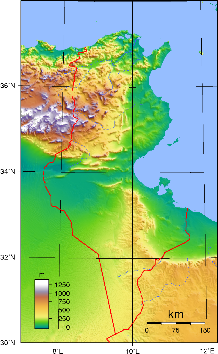
Summary
| Description | Topographic map of Tunisia. Created with GMT from SRTM data. |
| Date | |
| Source | Own work |
| Author | Sadalmelik |
Licensing
| This work has been released into the public domain by its author, I, Sadalmelik. This applies worldwide. In some countries this may not be legally possible; if so: I, Sadalmelik grants anyone the right to use this work for any purpose, without any conditions, unless such conditions are required by law. |
File history
Click on a date/time to view the file as it appeared at that time.
| Date/Time | Thumbnail | Dimensions | User | Comment | |
|---|---|---|---|---|---|
| current | 21:18, 29 June 2007 | | 733 × 1,192 (708 KB) | Sadalmelik | {{Information |Description=Topographic map of Tunisia. Created with GMT from SRTM data. |Source=self-made |Date=June 29, 2007 |Author= Sadalmelik }} Category:Maps of Tunisia Category:Topographic maps of Tunsia |
File usage
There are no pages that use this file.
Global file usage
The following other wikis use this file:
- Usage on ar.wikipedia.org
- Usage on ast.wikipedia.org
- Usage on avk.wikipedia.org
- Usage on be.wikipedia.org
- Usage on bg.wikipedia.org
- Usage on bs.wikipedia.org
- Usage on ca.wikipedia.org
- Usage on da.wikipedia.org
- Usage on diq.wikipedia.org
- Usage on el.wikipedia.org
- Usage on en.wikipedia.org
- Usage on es.wikipedia.org
- Usage on fr.wikipedia.org
- Usage on gd.wikipedia.org
- Usage on he.wikipedia.org
- Usage on hr.wiktionary.org
- Usage on hu.wikipedia.org
- Usage on hy.wikipedia.org
- Usage on hyw.wikipedia.org
- Usage on it.wikipedia.org
- Usage on ka.wikipedia.org
- Usage on ms.wikipedia.org
- Usage on pl.wikipedia.org
- Usage on pnb.wikipedia.org
- Usage on ru.wikipedia.org
- Usage on ru.wikimedia.org
- Usage on sr.wikipedia.org
- Usage on sv.wikipedia.org
- Usage on tr.wikipedia.org
- Usage on uk.wikipedia.org
View more global usage of this file.