
File:Tanzania Dodoma location map.svg

Size of this PNG preview of this SVG file: 630 × 600 pixels. Other resolutions: 252 × 240 pixels | 504 × 480 pixels | 807 × 768 pixels | 1,076 × 1,024 pixels | 2,152 × 2,048 pixels | 3,302 × 3,143 pixels.
Original file (SVG file, nominally 3,302 × 3,143 pixels, file size: 1.05 MB)
Summary
| Description | |
| Date | |
| Source | File:Tanzania location map.svg by Sémhur under licence GFDL or CC-BY-SA |
| Author | Sémhur |
| Other versions | |
| Attribution (required by the license) | © Sémhur / Wikimedia Commons / |
| SVG | W3C-validity not checked. |
| Graphic Lab |
| Object location | | View this and other nearby images on: OpenStreetMap |
|---|
Licensing
I, the copyright holder of this work, hereby publish it under the following licenses:
| Copyleft: This work of art is free; you can redistribute it and/or modify it according to terms of the Free Art License. You will find a specimen of this license on the Copyleft Attitude site as well as on other sites. |
This file is licensed under the Creative Commons Attribution-Share Alike 4.0 International, 3.0 Unported, 2.5 Generic, 2.0 Generic and 1.0 Generic license.
- You are free:
- to share – to copy, distribute and transmit the work
- to remix – to adapt the work
- Under the following conditions:
- attribution – You must give appropriate credit, provide a link to the license, and indicate if changes were made. You may do so in any reasonable manner, but not in any way that suggests the licensor endorses you or your use.
- share alike – If you remix, transform, or build upon the material, you must distribute your contributions under the same or compatible license as the original.
You may select the license of your choice.
File history
Click on a date/time to view the file as it appeared at that time.
| Date/Time | Thumbnail | Dimensions | User | Comment | |
|---|---|---|---|---|---|
| current | 13:35, 12 February 2018 | | 3,302 × 3,143 (1.05 MB) | Sémhur | Update with correct version. |
| 19:52, 28 June 2017 |  | 3,302 × 3,143 (1.04 MB) | Sémhur | Update with Songwe region | |
| 20:19, 9 June 2017 |  | 3,302 × 3,143 (1.04 MB) | Sémhur | Update with Songwe region | |
| 18:12, 13 December 2013 |  | 3,096 × 2,947 (1.38 MB) | Sémhur | Updated with 2012 new region boundaries | |
| 08:57, 3 May 2009 |  | 3,096 × 2,947 (829 KB) | Sémhur | Adding border between Arusha and Manyara | |
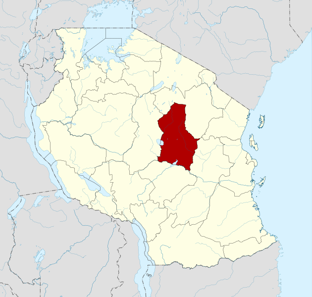
| 18:24, 2 May 2009 |  | 3,096 × 2,947 (823 KB) | Sémhur | =={{int:summary}}== {{Information |Description= {{en|1=Locator map of Dodoma region, Tanzania.}} {{es|1=Mapa de localización de la provincia de Dodoma, Tanzania.}} {{fr|1=Carte de localisation de la région de Dodoma, [[ |
File usage
There are no pages that use this file.
Global file usage
The following other wikis use this file:
- Usage on an.wikipedia.org
- Usage on ar.wikipedia.org
- Usage on avk.wikipedia.org
- Usage on bn.wikipedia.org
- Usage on cs.wikipedia.org
- Usage on da.wikipedia.org
- Usage on de.wikipedia.org
- Usage on el.wikipedia.org
- Usage on en.wikipedia.org
- Usage on es.wikipedia.org
- Usage on et.wikipedia.org
- Usage on eu.wikipedia.org
- Usage on fa.wikipedia.org
- Usage on fi.wikipedia.org
- Usage on frr.wikipedia.org
- Usage on fr.wikipedia.org
- Usage on he.wikipedia.org
- Usage on hi.wikipedia.org
- Usage on id.wikipedia.org
- Usage on it.wikipedia.org
- Usage on ja.wikipedia.org
- Usage on ka.wikipedia.org
- Usage on ko.wikipedia.org
- Usage on lv.wikipedia.org
- Usage on mk.wikipedia.org
- Usage on nl.wikipedia.org
- Usage on nn.wikipedia.org
- Usage on no.wikipedia.org
- Usage on pnb.wikipedia.org
- Usage on ru.wikipedia.org
- Usage on sw.wikipedia.org
- Usage on tr.wikipedia.org
- Usage on uk.wikipedia.org
- Usage on ur.wikipedia.org
- Usage on vi.wikipedia.org
- Usage on wuu.wikipedia.org
View more global usage of this file.