
File:Tadotsu in Kagawa Prefecture Ja.svg

Original file (SVG file, nominally 620 × 532 pixels, file size: 10 KB)
Summary
| Description |
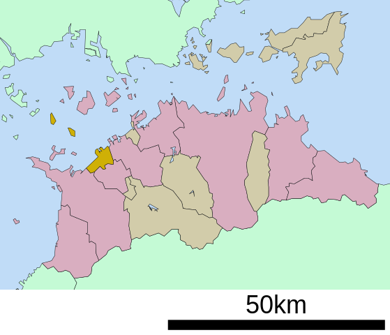
English: Location of Tadotsu in Kagawa Prefecture
|
||
| Date | (UTC) | ||
| Source |
|
||
| Author | Lincun | ||
| Permission (Reusing this file) |
|
Licensing

|
Permission is granted to copy, distribute and/or modify this document under the terms of the GNU Free Documentation License, Version 1.2 or any later version published by the Free Software Foundation; with no Invariant Sections, no Front-Cover Texts, and no Back-Cover Texts. A copy of the license is included in the section entitled GNU Free Documentation License. |
- You are free:
- to share – to copy, distribute and transmit the work
- to remix – to adapt the work
- Under the following conditions:
- attribution – You must give appropriate credit, provide a link to the license, and indicate if changes were made. You may do so in any reasonable manner, but not in any way that suggests the licensor endorses you or your use.
- share alike – If you remix, transform, or build upon the material, you must distribute your contributions under the same or compatible license as the original.
Original upload log
| This file was moved from Japanese Wikipedia.
See below for original file information. | ||||||||||||||||||||||||
| ||||||||||||||||||||||||
|
| ||||||||||||||||||||||||
File history
Click on a date/time to view the file as it appeared at that time.
| Date/Time | Thumbnail | Dimensions | User | Comment | |
|---|---|---|---|---|---|
| current | 09:36, 22 September 2009 | | 620 × 532 (10 KB) | Monaneko | {{Information |Description={{en|1=Location of Tadotsu in Kagawa Prefecture}} {{ja|1=香川県仲多度郡多度津町の位置}} |Source=ja:File:包括自治体区画図 37404.svg |Author=ja:User:Lincun |Date=2007-10-16 14:22 (UTC) |Permission= |
| 14:22, 16 October 2007 |  | 620 × 532 (10 KB) | Lincun | {{基礎自治体位置図画像情報|香川県|多度津町}} |
File usage
The following page uses this file:
Global file usage
The following other wikis use this file:
- Usage on arz.wikipedia.org
- Usage on ast.wikipedia.org
- Usage on ca.wikipedia.org
- Usage on de.wikipedia.org
- Usage on en.wikipedia.org
- Usage on es.wikipedia.org
- Usage on fa.wikipedia.org
- Usage on id.wikipedia.org
- Usage on ja.wikipedia.org
- Usage on km.wikipedia.org
- Usage on ko.wikipedia.org
- Usage on ms.wikipedia.org
- Usage on sv.wikipedia.org
- Usage on uk.wikipedia.org
- Usage on vi.wikipedia.org
- Usage on www.wikidata.org
- Usage on zh.wikipedia.org