
File:Spitak locator map.png
No higher resolution available.
Spitak_locator_map.png (150 × 148 pixels, file size: 7 KB, MIME type: image/png)
Summary
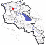
| Description | Location map for , Armenia. |
| Date | 20 September 2006 (original upload date) |
| Source | No machine-readable source provided. Own work assumed (based on copyright claims). |
| Author | No machine-readable author provided. FHen assumed (based on copyright claims). |
Licensing
FHen, the copyright holder of this work, hereby publishes it under the following license:
| I, the copyright holder of this work, release this work into the public domain. This applies worldwide. In some countries this may not be legally possible; if so: I grant anyone the right to use this work for any purpose, without any conditions, unless such conditions are required by law. |
File history
Click on a date/time to view the file as it appeared at that time.
| Date/Time | Thumbnail | Dimensions | User | Comment | |
|---|---|---|---|---|---|
| current | 18:19, 20 September 2006 | | 150 × 148 (7 KB) | FHen | Location map for Spitak, Armenia. {{PD-user|FHen}} Category:Maps of Armenia |
File usage
The following page uses this file:
Global file usage
The following other wikis use this file:
- Usage on fa.wikipedia.org
- Usage on id.wikipedia.org
- Usage on ms.wikipedia.org
- Usage on pt.wikipedia.org