
File:SatTiticacaSee-boundary.jpg
Size of this preview: 800 × 590 pixels. Other resolutions: 320 × 236 pixels | 640 × 472 pixels | 1,024 × 755 pixels | 1,280 × 944 pixels.
Original file (1,280 × 944 pixels, file size: 765 KB, MIME type: image/jpeg)
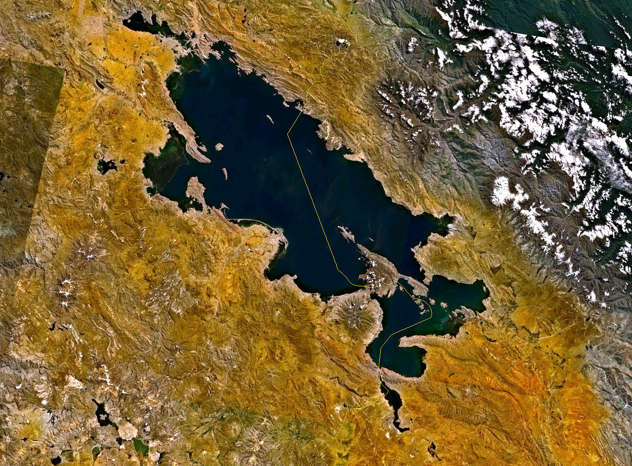
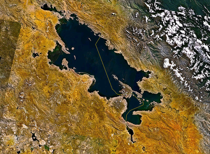
- Satellitenaufnahme vom Titicaca See mit Grenzverlauf
- from Nasa World Wind - Free Satellite Image
| This image is in the public domain because it is a screenshot from NASA’s globe software World Wind using a public domain layer, such as Blue Marble, MODIS, Landsat, SRTM, USGS or GLOBE.
|
 |
File history
Click on a date/time to view the file as it appeared at that time.
| Date/Time | Thumbnail | Dimensions | User | Comment | |
|---|---|---|---|---|---|
| current | 11:05, 29 December 2005 | | 1,280 × 944 (765 KB) | Godewind | * Satellitenaufnahme vom Titicaca See mit Grenzverlauf * from Nasa World Wind - Free Satellite Image {{PD-USGov}} Category:Satellite photos |
File usage
The following page uses this file:
Global file usage
The following other wikis use this file:
- Usage on af.wikipedia.org
- Usage on de.wikipedia.org
- Usage on es.wikipedia.org
- Usage on et.wikipedia.org
- Usage on fi.wikipedia.org
- Usage on fr.wikipedia.org
- Usage on lv.wikipedia.org
- Usage on qu.wikipedia.org
- Usage on tr.wikipedia.org