
File:Plan-Nice-1624-Sincaire.jpg

Size of this preview: 774 × 600 pixels. Other resolutions: 310 × 240 pixels | 619 × 480 pixels | 991 × 768 pixels | 1,280 × 992 pixels | 1,974 × 1,530 pixels.
Original file (1,974 × 1,530 pixels, file size: 707 KB, MIME type: image/jpeg)
Summary
| Description |
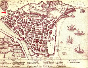
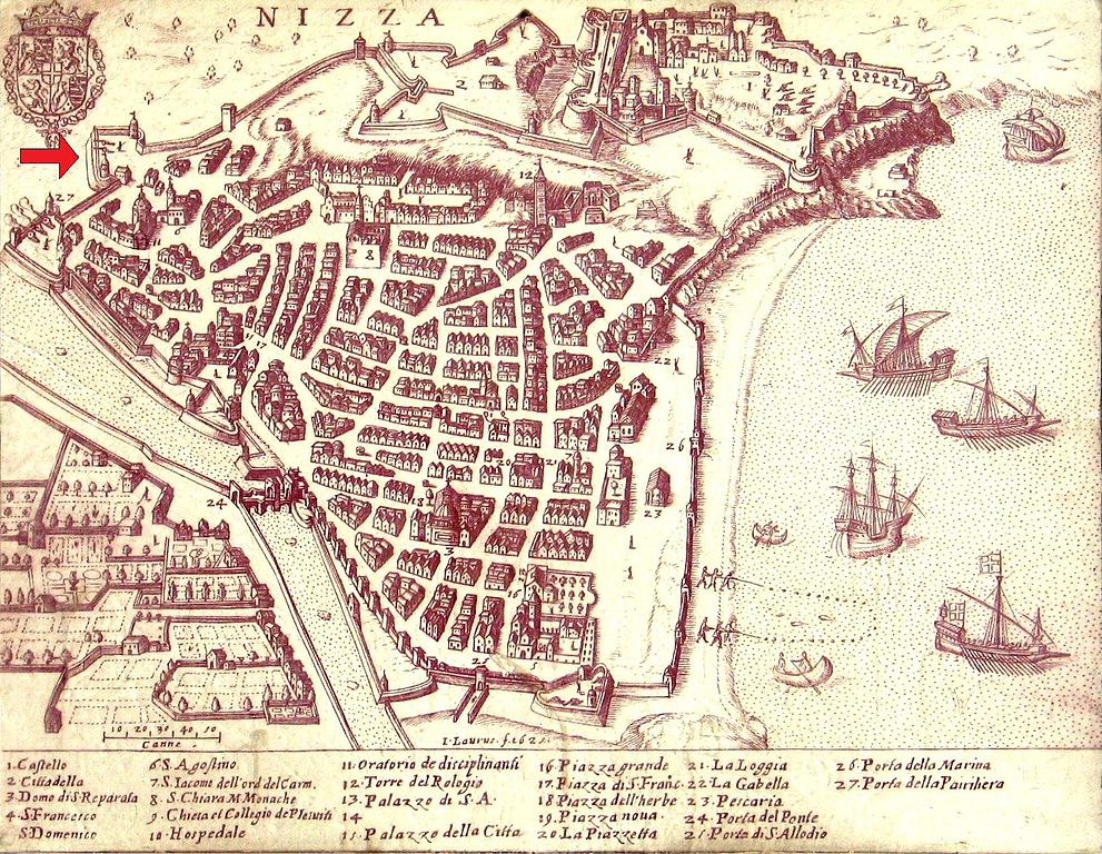
English: City map of Nice in 1624. The red arrow indicates the location of the bastion Sincaïre.
Français : Plan de la ville de Nice en 1624. La flèche rouge indique l'emplacement du bastion Sincaïre. |
| Date | |
| Source | Photograph of a map placed outdoor in the old city of Nice. Enhanced by Nataraja. Red arrow added by Assalit |
| Author | Unknown author |
| Other versions |
|


Licensing
|
This work is in the public domain in its country of origin and other countries and areas where the copyright term is the author's life plus 100 years or fewer. This work is in the public domain in the United States because it was published (or registered with the U.S. Copyright Office) before January 1, 1929. | |
| This file has been identified as being free of known restrictions under copyright law, including all related and neighboring rights. | |
File history
Click on a date/time to view the file as it appeared at that time.
| Date/Time | Thumbnail | Dimensions | User | Comment | |
|---|---|---|---|---|---|
| current | 16:23, 27 September 2010 | | 1,974 × 1,530 (707 KB) | Assalit~commonswiki | {{Information |Description= |Source= |Author= |Date= }} Photograph enhanced by Nataraja. Red arrow added by Assalit. 1624 Category:Quartier du Vieux-Nice [[Category:Historical images of Nice |
File usage
The following page uses this file:
Global file usage
The following other wikis use this file: