
File:Montenegro Map.png

Original file (2,427 × 1,807 pixels, file size: 1.03 MB, MIME type: image/png)
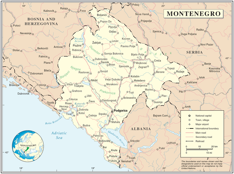
Map of Montenegro
| Description | Map of Montenegro | |||
| Date | ||||
| Source | The Cartographic Section of the United Nations (CSUN) | |||
| Author | Cartographer of the United Nations | |||
| Permission (Reusing this file) |
|

File history
Click on a date/time to view the file as it appeared at that time.
| Date/Time | Thumbnail | Dimensions | User | Comment | |
|---|---|---|---|---|---|
| current | 17:03, 10 March 2007 | | 2,427 × 1,807 (1.03 MB) | Minestrone | Map of Montenegro {{Information |Description=Map of Montenegro |Source=The Cartographic Section of the United Nations (CSUN) |Date=2007-03-10 |Author=Cartographer of the United Nations |Permission={{Template:UN map}} and the cartographer of the UN [ |
File usage
The following page uses this file:
Global file usage
The following other wikis use this file:
- Usage on als.wikipedia.org
- Usage on ar.wikipedia.org
- Usage on avk.wikipedia.org
- Usage on be-tarask.wikipedia.org
- Usage on bg.wikipedia.org
- Usage on cs.wikipedia.org
- Usage on cy.wikipedia.org
- Usage on de.wikipedia.org
- Usage on el.wikipedia.org
- Usage on en.wikipedia.org
- Usage on fa.wikipedia.org
- Usage on fr.wikipedia.org
- Usage on gag.wikipedia.org
- Usage on gd.wikipedia.org
- Usage on hr.wiktionary.org
- Usage on ia.wikipedia.org
- Usage on io.wikipedia.org
- Usage on ka.wikipedia.org
- Usage on la.wikipedia.org
- Usage on ms.wikipedia.org
- Usage on nl.wikipedia.org
- Usage on pl.wikipedia.org
- Usage on pl.wiktionary.org
- Usage on pnb.wikipedia.org
- Usage on ps.wikipedia.org
- Usage on rm.wikipedia.org
- Usage on roa-tara.wikipedia.org
- Usage on ro.wikipedia.org
- Usage on ro.wikivoyage.org
- Usage on ru.wikipedia.org
View more global usage of this file.