
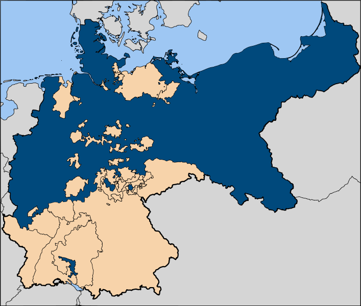
File:Map-DR-Prussia.svg

Size of this PNG preview of this SVG file: 707 × 600 pixels. Other resolutions: 283 × 240 pixels | 566 × 480 pixels | 905 × 768 pixels | 1,207 × 1,024 pixels | 2,414 × 2,048 pixels | 2,621 × 2,224 pixels.
Original file (SVG file, nominally 2,621 × 2,224 pixels, file size: 712 KB)
| Description | |
| Date | |
| Source |
English: Based on map data of the IEG-Maps project (Andreas Kunz, B. Johnen and Joachim Robert Moeschl: University of Mainz) — http://www.ieg-maps.uni-mainz.de
Русский: Основано на карте проекта IEG-Maps (Андреас Кунц, Б. Йонен и Йоахим Роберт Моешль: Университет Майнца) — http://www.ieg-maps.uni-mainz.de |
| Author | User:52 Pickup |
| Permission (Reusing this file) |
This file is licensed under the Creative Commons Attribution-Share Alike 2.5 Generic license.
|
File history
Click on a date/time to view the file as it appeared at that time.
| Date/Time | Thumbnail | Dimensions | User | Comment | |
|---|---|---|---|---|---|
| current | 11:43, 11 January 2007 | | 2,621 × 2,224 (712 KB) | 52 Pickup | improved colour scheme |
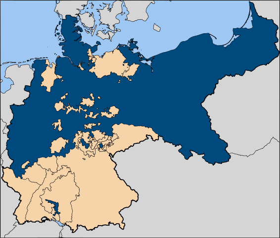
| 12:30, 7 December 2006 |  | 2,621 × 2,224 (712 KB) | 52 Pickup | ||
| 17:52, 29 November 2006 |  | 2,621 × 2,224 (1.05 MB) | Bonas | {{Information |Description=The Kingdom of Prussia within the German Empire |Source=Image:Map-DR-Prussia.svg, map data from the IEG-Maps project by Andreas Kunz, B. Johnen an |
File usage
The following page uses this file:
Global file usage
The following other wikis use this file:
- Usage on af.wikipedia.org
- Usage on am.wikipedia.org
- Usage on ang.wikipedia.org
- Usage on an.wikipedia.org
- Usage on ar.wikipedia.org
- Usage on arz.wikipedia.org
- Usage on ast.wikipedia.org
- Usage on az.wikipedia.org
- Usage on ba.wikipedia.org
- Usage on be-tarask.wikipedia.org
- Usage on be.wikipedia.org
- Usage on bg.wikipedia.org
- Usage on br.wikipedia.org
- Usage on ca.wikipedia.org
- Usage on ce.wikipedia.org
- Usage on cs.wikipedia.org
- Usage on cy.wikipedia.org
- Usage on da.wikipedia.org
- Usage on de.wikipedia.org
- Usage on diq.wikipedia.org
- Usage on dsb.wikipedia.org
- Usage on en.wikipedia.org
- Talk:Prussia/Archive 1
- User:JALockhart
- User:JALockhart/Userboxes/User int GerHist
- E11 European long distance path
- User:Scriberius/Projects/Babelmania
- User:Basler04/Books/German Unification2
- User:Basler04/GE
- User:MechaChrist
- User:Dainomite/sandbox
- User:Stephen2nd/Sandbox (a)
- User talk:Stephen2nd/Template sandbox B
- Usage on en.wikivoyage.org
- Usage on eo.wikipedia.org
View more global usage of this file.