
File:Locatie Bandazee.PNG
No higher resolution available.
Locatie_Bandazee.PNG (484 × 362 pixels, file size: 13 KB, MIME type: image/png)
Summary
| Description |
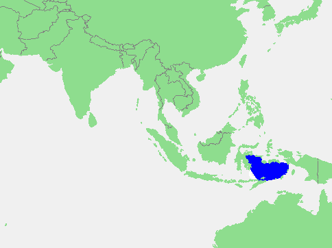
English: Banda Sea
Español: Mar de Banda |
||||
| Source | own work based on PD map | ||||
| Author | edited by M.Minderhoud | ||||
| Permission (Reusing this file) |
|
File history
Click on a date/time to view the file as it appeared at that time.
| Date/Time | Thumbnail | Dimensions | User | Comment | |
|---|---|---|---|---|---|
| current | 08:51, 6 March 2010 | | 484 × 362 (13 KB) | Xufanc | Extended sea towards the west. |
| 12:44, 17 September 2006 |  | 484 × 362 (13 KB) | Michiel1972 | {{Information |Description= Banda Sea |Source= own work based on PD map |Date= |Author= edited by M.Minderhoud |Permission= {{PD-Demis}} |other_versions= }} category:Locator maps of seas |
File usage
The following page uses this file:
Global file usage
The following other wikis use this file:
- Usage on af.wikipedia.org
- Usage on an.wikipedia.org
- Usage on ar.wikipedia.org
- Usage on ast.wikipedia.org
- Usage on avk.wikipedia.org
- Usage on az.wikipedia.org
- Usage on ban.wikipedia.org
- Usage on bn.wikipedia.org
- Usage on br.wikipedia.org
- Usage on bs.wikipedia.org
- Usage on ca.wikipedia.org
- Usage on cs.wikipedia.org
- Usage on cv.wikipedia.org
- Usage on da.wikipedia.org
- Usage on de.wikipedia.org
- Usage on en.wikipedia.org
- Usage on en.wiktionary.org
- Usage on eo.wikipedia.org
- Usage on es.wikipedia.org
- Usage on et.wikipedia.org
- Usage on eu.wikipedia.org
- Usage on fa.wikipedia.org
- Usage on fi.wikipedia.org
- Usage on frr.wikipedia.org
- Usage on fr.wikipedia.org
- Usage on fy.wikipedia.org
- Usage on gl.wikipedia.org
- Usage on he.wikipedia.org
- Usage on hu.wikipedia.org
- Usage on hy.wikipedia.org
- Usage on id.wikipedia.org
- Usage on ilo.wikipedia.org
- Usage on it.wikipedia.org
- Usage on ja.wikipedia.org
- Usage on jv.wikipedia.org
- Usage on ka.wikipedia.org
- Usage on kk.wikipedia.org
- Usage on ko.wikipedia.org
- Usage on lt.wikipedia.org
View more global usage of this file.