
File:Latrans-Turkey location Kastamonu.svg

Size of this PNG preview of this SVG file: 800 × 356 pixels. Other resolutions: 320 × 142 pixels | 640 × 285 pixels | 1,024 × 455 pixels | 1,280 × 569 pixels | 2,560 × 1,138 pixels | 1,473 × 655 pixels.
Original file (SVG file, nominally 1,473 × 655 pixels, file size: 10.88 MB)
Summary
| Description |
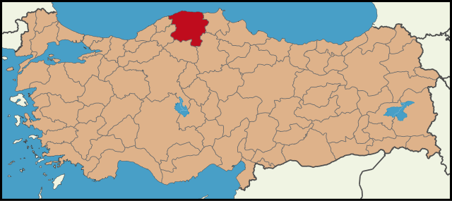
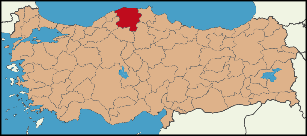
English: Location map for Kastamonu.
Türkçe: Kastamonu'nun konumunu gösteren harita. |
| Date | |
| Source | Own work |
| Author | The Emirr |
Licensing
I, the copyright holder of this work, hereby publish it under the following licenses:

|
Permission is granted to copy, distribute and/or modify this document under the terms of the GNU Free Documentation License, Version 1.2 or any later version published by the Free Software Foundation; with no Invariant Sections, no Front-Cover Texts, and no Back-Cover Texts. A copy of the license is included in the section entitled GNU Free Documentation License. |
| This file is licensed under the Creative Commons Attribution-Share Alike 3.0 Unported license. | ||
| ||
| This licensing tag was added to this file as part of the GFDL licensing update. |
This file is licensed under the Creative Commons Attribution 3.0 Unported license.
- You are free:
- to share – to copy, distribute and transmit the work
- to remix – to adapt the work
- Under the following conditions:
- attribution – You must give appropriate credit, provide a link to the license, and indicate if changes were made. You may do so in any reasonable manner, but not in any way that suggests the licensor endorses you or your use.
You may select the license of your choice.
File history
Click on a date/time to view the file as it appeared at that time.
| Date/Time | Thumbnail | Dimensions | User | Comment | |
|---|---|---|---|---|---|
| current | 08:02, 26 June 2009 | | 1,473 × 655 (10.88 MB) | The Emirr | {{Information |Description={{en|1=Location map for Kastamonu.}} {{tr|1=Kastamonu'nun konumunu gösteren harita.}} |Source=Own work by uploader |Author=The Emirr |Date=26.06.2009 |Permission={{The Emirr}} |other_versions=There is not ano |
File usage
The following page uses this file:
Global file usage
The following other wikis use this file:
- Usage on cy.wikipedia.org
- Usage on fr.wikipedia.org
- Usage on hy.wikipedia.org
- Usage on mrj.wikipedia.org
- Usage on pnb.wikipedia.org
- Usage on pt.wikipedia.org
- Usage on tr.wikipedia.org
- Usage on tr.wikivoyage.org
- Usage on uz.wikipedia.org
- Andoza:Abana tumani
- Abana (Kastamonu)
- Yeşilyuva, Abana
- Yemeni, Abana
- Yakabaşı, Abana
- Denizbükü (Abana)
- Kadıyusuf, Abana
- Elmaçukuru, Abana
- Altıkulaç, Abana
- Yeşilköy
- Toybelen (Kemaliye)
- Andoza:Derelining qishloqlari
- Ağapınar
- Andoza:Niğde tumaniga qarashli qishloqlari
- Aydınlar (Kaman)
- Andoza:Taşova tumanining qishloqlari
- Başköy (Kaman)
- Bayındır (Kaman)
- Andoza:Kars tumaniga qarashli qishloqlar
- Bayramözü
View more global usage of this file.