
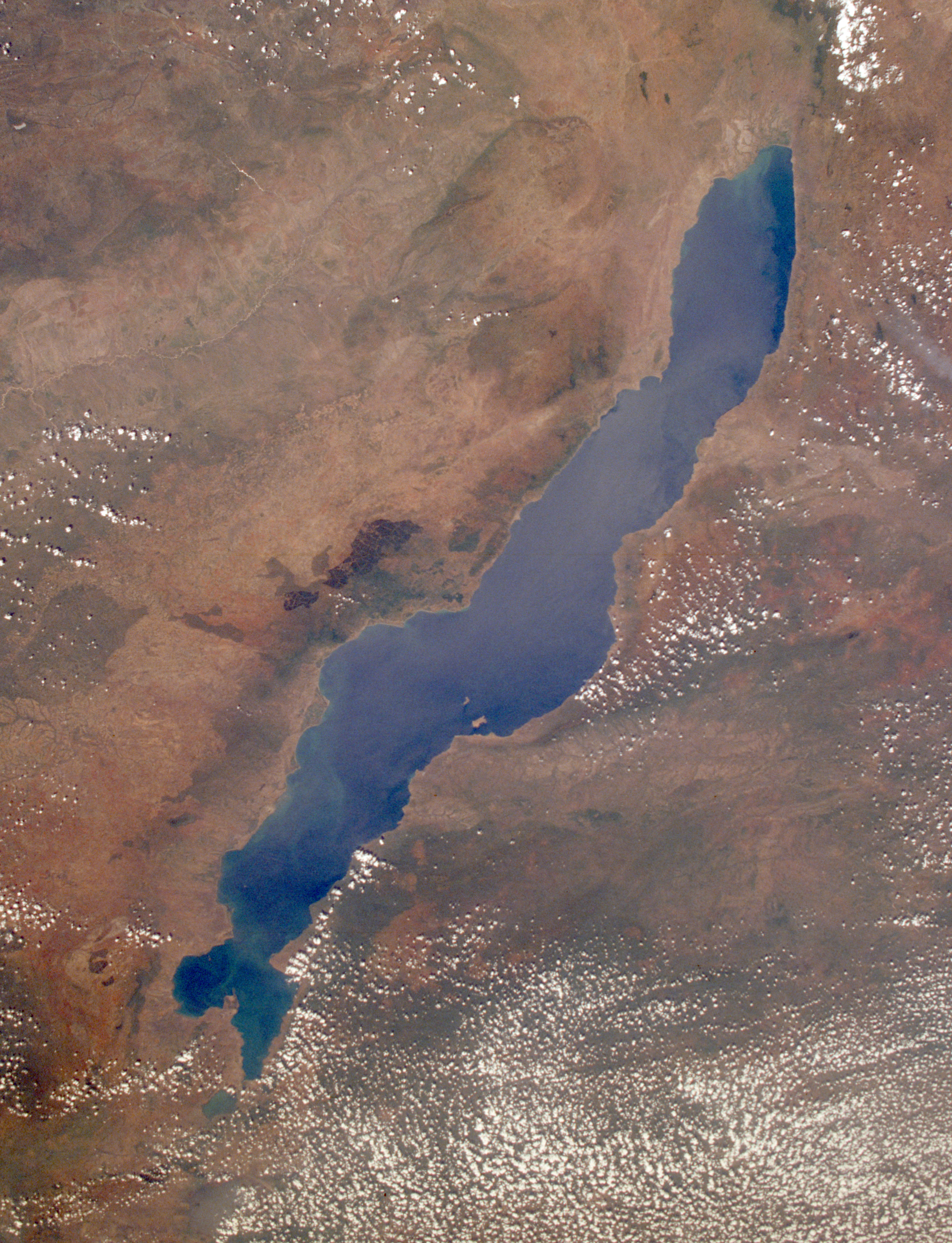
File:Lake Malawi seen from orbit.jpg
Size of this preview: 459 × 599 pixels. Other resolutions: 184 × 240 pixels | 367 × 480 pixels | 588 × 768 pixels | 784 × 1,024 pixels | 1,568 × 2,048 pixels | 2,778 × 3,628 pixels.
Original file (2,778 × 3,628 pixels, file size: 3.24 MB, MIME type: image/jpeg)
Summary
| Description |
English: Leverkusen in Germany, photographed by astronauts aboard the Space Shuttle. Original image courtesy of the Image Analysis Laboratory, NASA Johnson Space Center (eol.jsc.nasa.gov). Image ID: STS061-75-48. Image cropped, sharpened and gamma-corrected.
|
| Date | Taken on 3 December 1998, 09:49:31 UTC |
| Source | https://eol.jsc.nasa.gov/SearchPhotos/photo.pl?mission=STS061&roll=75&frame=48 |
| Author | National Aeronautics and Space Administration (NASA) |
| Other versions |

This image or video was catalogued by Johnson Space Center of the United States National Aeronautics and Space Administration (NASA) under Photo ID: STS061-75-48. This tag does not indicate the copyright status of the attached work. A normal copyright tag is still required. See Commons:Licensing. Other languages:
|
Licensing
This file is in the public domain in the United States because it was created by the Image Science & Analysis Laboratory, of the NASA Johnson Space Center. NASA copyright policy states that "NASA material is not protected by copyright unless noted". (NASA media use guidelines or Conditions of Use of Astronaut Photographs).
Photo source: STS061-75-48.
|
Original upload log
Uploaded to en wiki by User:Worldtraveller; moved here by User:Tintazul. Full original description follows.
File history
Click on a date/time to view the file as it appeared at that time.
| Date/Time | Thumbnail | Dimensions | User | Comment | |
|---|---|---|---|---|---|
| current | 19:17, 30 August 2019 | | 2,778 × 3,628 (3.24 MB) | Ras67 | high resolution, cropped and rotated from NASA's original TIFF |
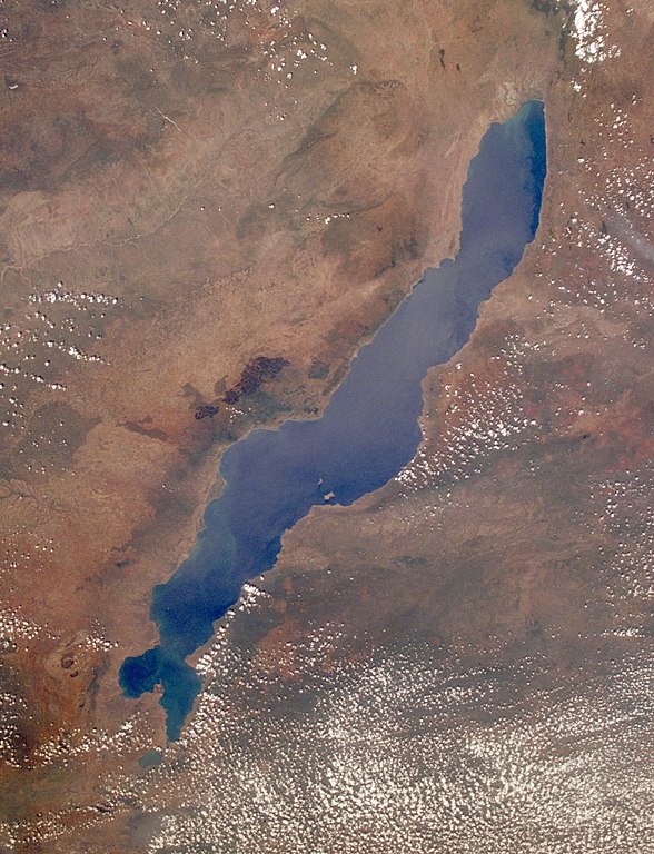
| 12:27, 4 November 2005 |  | 768 × 1,000 (271 KB) | Tintazul | ''Uploaded to en wiki by User:Worldtraveller; moved here by User:Tintazul. Full original description follows.'' Lake Malawi in Africa, photographed by astronauts aboard the Space Shuttle. Original image courtesy of the Image Analysis Laboratory, |
File usage
The following page uses this file:
Global file usage
The following other wikis use this file:
- Usage on af.wikipedia.org
- Usage on als.wikipedia.org
- Usage on ar.wikipedia.org
- Usage on arz.wikipedia.org
- Usage on az.wikipedia.org
- Usage on ba.wikipedia.org
- Usage on be-tarask.wikipedia.org
- Usage on be.wikipedia.org
- Usage on bg.wikipedia.org
- Dimidiochromis compressiceps
- Labeotropheus trewavasae
- Labidochromis caeruleus
- Maylandia aurora
- Maylandia barlowi
- Maylandia benetos
- Maylandia callainos
- Maylandia chrysomallos
- Maylandia elegans
- Maylandia emmiltos
- Maylandia hajomaylandi
- Maylandia heteropicta
- Maylandia mbenjii
- Maylandia melabranchion
- Maylandia phaeos
- Maylandia pursa
- Maylandia pyrsonotos
- Maylandia thapsinogen
- Melanochromis parallelus
- Nimbochromis linni
- Nimbochromis polystigma
- Otopharynx brooksi
- Otopharynx lithobates
- Otopharynx tetrastigma
- Placidochromis electra
- Placidochromis johnstoni
- Placidochromis phenochilus
- Protomelas spilonotus
View more global usage of this file.