
File:Karte Map Somalia.gif
Size of this preview: 497 × 599 pixels. Other resolutions: 199 × 240 pixels | 398 × 480 pixels | 985 × 1,187 pixels.
Original file (985 × 1,187 pixels, file size: 178 KB, MIME type: image/gif)
Summary

|
This locator map image could be re-created using vector graphics as an SVG file. This has several advantages; see Commons:Media for cleanup for more information. If an SVG form of this image is available, please upload it and afterwards replace this template with
{{vector version available|new image name}}.
It is recommended to name the SVG file “Karte Map Somalia.svg”—then the template Vector version available (or Vva) does not need the new image name parameter. |
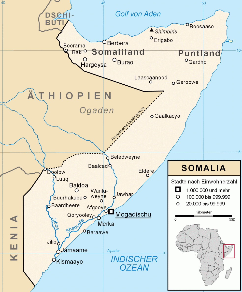
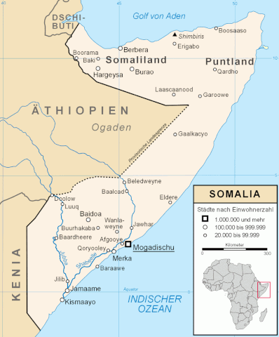
| Description | Karte Somalia mit Städten mit mehr als 20.000 Einwohnern |
| Date | |
| Source | Own work |
| Author | Lencer |

|
This map has been made or improved in the German Kartenwerkstatt (Map Lab). You can propose maps to improve as well.
|
Licensing
I, the copyright holder of this work, hereby publish it under the following license:
This file is licensed under the Creative Commons Attribution-Share Alike 2.5 Generic license.
- You are free:
- to share – to copy, distribute and transmit the work
- to remix – to adapt the work
- Under the following conditions:
- attribution – You must give appropriate credit, provide a link to the license, and indicate if changes were made. You may do so in any reasonable manner, but not in any way that suggests the licensor endorses you or your use.
- share alike – If you remix, transform, or build upon the material, you must distribute your contributions under the same or compatible license as the original.
File history
Click on a date/time to view the file as it appeared at that time.
| Date/Time | Thumbnail | Dimensions | User | Comment | |
|---|---|---|---|---|---|
| current | 13:13, 12 April 2020 | | 985 × 1,187 (178 KB) | Ras67 | black frame removed |
| 17:28, 22 June 2007 |  | 997 × 1,200 (183 KB) | Lencer | ||
| 20:23, 19 June 2007 |  | 997 × 1,200 (153 KB) | Lencer | ||
| 19:01, 19 June 2007 |  | 997 × 1,200 (129 KB) | Lencer | ||
| 18:54, 19 June 2007 |  | 997 × 1,200 (128 KB) | Lencer | ||
| 17:25, 19 June 2007 |  | 997 × 1,200 (195 KB) | Lencer | ||
| 15:57, 19 June 2007 |  | 997 × 1,200 (199 KB) | Lencer | {{Information |Description=Karte Somalia mit Städten mit mehr als 20.000 Einwohnern |Source=selbst erstellt |Date=Juni 2007 |Author=Lencer |other_versions= }} {{Kartenwerkstatt}} == Licensing == {{self|cc-by-sa-2.5}} [[ |
File usage
The following 3 pages use this file:
Global file usage
The following other wikis use this file:
- Usage on als.wikipedia.org
- Usage on da.wikipedia.org
- Usage on de.wikipedia.org
- Liste der Städte in Somalia
- Benutzer:Lencer
- Benutzer:Lencer/Galerie
- Gaalkacyo
- Jowhar
- Afgooye
- Qoryooley
- Jilib
- Wanlaweyne
- Garbahaarrey
- Eldheere
- Geschichte Somalias
- Zeittafel Somalia
- Geographie Somalias
- Hungersnot in Somalia in den 1990er-Jahren
- Wikipedia:Kartenwerkstatt/Archiv/2007-06
- Benutzer:Lencer/Unterseite
- Wikipedia:Kartenwerkstatt/Positionskarten/Afrika
- Benutzer:Uwe Dedering/Länderliste
- Usage on de.wikinews.org
- Usage on eo.wikipedia.org
- Usage on fi.wikipedia.org
- Usage on fr.wikipedia.org
- Usage on gag.wikipedia.org
- Usage on hr.wikipedia.org
- Usage on it.wikipedia.org
- Usage on la.wikipedia.org
- Usage on no.wikipedia.org
- Usage on pl.wikipedia.org
- Usage on pt.wikipedia.org
- Usage on sv.wikipedia.org
- Usage on uk.wikipedia.org