
File:France-régions (fr).svg

Size of this PNG preview of this SVG file: 574 × 600 pixels. Other resolutions: 230 × 240 pixels | 459 × 480 pixels | 735 × 768 pixels | 980 × 1,024 pixels | 1,959 × 2,048 pixels | 619 × 647 pixels.
Original file (SVG file, nominally 619 × 647 pixels, file size: 1.15 MB)
.svg)
Summary
| Description |
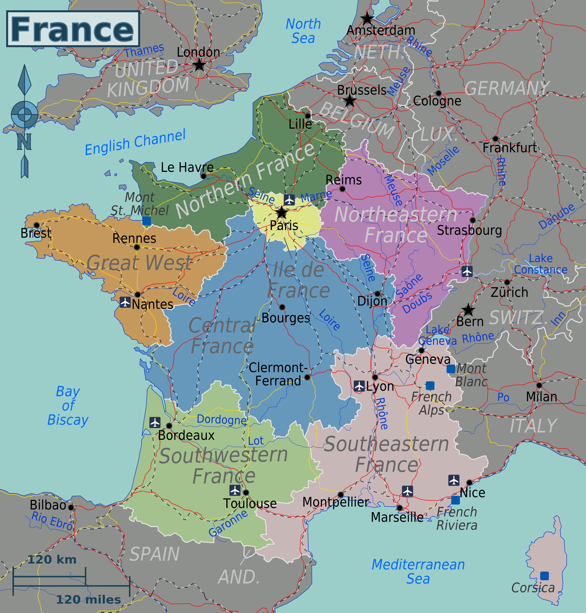
English: Map of France in french Français : Carte de France - Grandes régions touristiques |
| Date | |
| Source | http://upload.wikimedia.org/wikipedia/commons/6/63/France-regions.png |
| Author | User:Globe-trotter |
Licensing
| This file is made available under the Creative Commons CC0 1.0 Universal Public Domain Dedication. | |
| The person who associated a work with this deed has dedicated the work to the public domain by waiving all of their rights to the work worldwide under copyright law, including all related and neighboring rights, to the extent allowed by law. You can copy, modify, distribute and perform the work, even for commercial purposes, all without asking permission.
|
File history
Click on a date/time to view the file as it appeared at that time.
| Date/Time | Thumbnail | Dimensions | User | Comment | |
|---|---|---|---|---|---|
| current | 22:36, 12 April 2013 | | 619 × 647 (1.15 MB) | Adehertogh | User created page with UploadWizard |
File usage
The following page uses this file:
Global file usage
The following other wikis use this file:
- Usage on fr.wikivoyage.org
- Usage on sr.wiktionary.org
- Usage on uk.wikipedia.org
.svg)