
File:Extensión del ruso2.png
No higher resolution available.
Extensión_del_ruso2.png (380 × 315 pixels, file size: 89 KB, MIME type: image/png)
| Description |
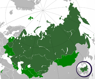
Español: Extensión del ruso. |
| Date | (UTC) |
| Source | |
| Author |
|
.svg)
I, the copyright holder of this work, hereby publish it under the following licenses:
This file is licensed under the Creative Commons Attribution 3.0 Unported license.
- You are free:
- to share – to copy, distribute and transmit the work
- to remix – to adapt the work
- Under the following conditions:
- attribution – You must give appropriate credit, provide a link to the license, and indicate if changes were made. You may do so in any reasonable manner, but not in any way that suggests the licensor endorses you or your use.
The map has been created with the Generic Mapping Tools: https://www.generic-mapping-tools.org/ using one or more of these public-domain datasets for the relief:
|

|
Permission is granted to copy, distribute and/or modify this document under the terms of the GNU Free Documentation License, Version 1.2 or any later version published by the Free Software Foundation; with no Invariant Sections, no Front-Cover Texts, and no Back-Cover Texts. A copy of the license is included in the section entitled GNU Free Documentation License. |
You may select the license of your choice.
Original upload log
This image is a derivative work of the following images:
- File:Russian_Federation_(orthographic_projection).svg licensed with Cc-by-3.0, GFDL-GMT
- 2008-11-24T03:09:11Z Shibo77 541x541 (586989 Bytes) {{Information |Description=.. |Source=.. |Date=.. |Author=Ssolbergj |Permission=.. |other_versions=.. }}
- 2008-10-30T17:14:56Z Shibo77 541x541 (586026 Bytes) +Kurilojn k Grandan Diomedeon
- 2008-10-21T00:09:37Z Ssolbergj 541x541 (583897 Bytes) {{Information |Description= |Source= |Date= |Author= |Permission= |other_versions= }}
- 2008-10-21T00:01:03Z Ssolbergj 765x990 (426047 Bytes) {{Information |Description={{en|1=Russia}} |Source=Own work by uploader |Author=[[User:Ssolbergj|Ssolbergj]] |Date= |Permission= |other_versions= }} [[Category:Maps of Russia]]
Uploaded with derivativeFX
File history
Click on a date/time to view the file as it appeared at that time.
| Date/Time | Thumbnail | Dimensions | User | Comment | |
|---|---|---|---|---|---|
| current | 02:00, 20 July 2015 | | 380 × 315 (89 KB) | Viet-hoian1 | Actualización de Donetsk y Lugansk |
| 20:33, 8 April 2014 |  | 380 × 315 (73 KB) | Iñaki Salazar | Reverted to version as of 12:32, 21 March 2014 | |
| 15:40, 21 March 2014 |  | 380 × 315 (91 KB) | Bobek | Reverted to version as of 22:59, 5 March 2011 | |
| 12:32, 21 March 2014 |  | 380 × 315 (73 KB) | Мечников | Крым | |
| 22:59, 5 March 2011 |  | 380 × 315 (91 KB) | Wadim | Mapa confuso; mezcla idioma oficial (nacional) con oficial (local) (especialmente en Ucrania); podría existir con explicación apropiada como imagen independiente de esta | |
| 05:11, 7 February 2011 |  | 380 × 315 (66 KB) | Fobos92 | Mapa en tres colores. | |
| 00:55, 7 January 2010 |  | 380 × 315 (91 KB) | Wadim | {{Information |Description={{en|Russia on the globe.}} {{ru|Россия на глобусе.}} {{tr|'''Rusya''''nın yerküre üzerindeki konumu.}} |Source=*File:Russian_Federation_(orthographic_projection).svg |Date=2010-01-07 00:44 (UTC) |Aut |
.svg)
File usage
There are no pages that use this file.
Global file usage
The following other wikis use this file:
- Usage on alt.wikipedia.org
- Usage on ru.wikipedia.org