
File:EuropeLocation.svg

Size of this PNG preview of this SVG file: 463 × 236 pixels. Other resolutions: 320 × 163 pixels | 640 × 326 pixels | 1,024 × 522 pixels | 1,280 × 652 pixels | 2,560 × 1,305 pixels.
Original file (SVG file, nominally 463 × 236 pixels, file size: 290 KB)
| Description |
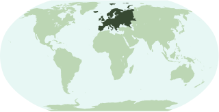
English: Map showing the location of the continent of Europe.
Français : Une carte pour démontrer la location du continent de l'Europe.
Interlingua: Un Mapa monstrante le location del continente de Europa.
Русский: Местоположение Европы на карте мира. |
||
| Date | |||
| Source | Own work | ||
| Author | Notscott | ||
| Permission (Reusing this file) |
|
||
| Other versions |
 |
File history
Click on a date/time to view the file as it appeared at that time.
| Date/Time | Thumbnail | Dimensions | User | Comment | |
|---|---|---|---|---|---|
| current | 01:50, 15 January 2007 | | 463 × 236 (290 KB) | Notscott | |
| 01:39, 15 January 2007 |  | 463 × 236 (290 KB) | Notscott | == Summary == {{en|Map showing the location of the continent of Europe.}} {{fr|Une carte pour démontrer la location du continent de l'Europe.}} {{ia|Un Mapa monstrante le location del continente de Europa.}} == Licensing == {{PD-self}} [[Category:Locat |
File usage
There are no pages that use this file.
Global file usage
The following other wikis use this file:
- Usage on ar.wikipedia.org
- Usage on arz.wikipedia.org
- البانيا
- مقدونيا الشماليه
- قالب:امريكا الجنوبية/شرح
- قالب:اوروبا
- قالب:شرح استعمال قوالب القارات
- شعارات دول اوروبا
- الاحزاب السياسية فى تركيا
- الاحزاب السياسيه فى ايطاليا
- الاحزاب السياسيه فى المانيا
- الاحزاب السياسيه فى اليونان
- الاحزاب السياسيه فى السويد
- الاحزاب السياسية فى قبرص
- الاحزاب السياسية فى ارمينيا
- الاحزاب السياسيه فى مالطا
- ماديرا
- قالب:شعارات أوروبا
- نقاش القالب:شعارات أوروبا
- الاحزاب السياسيه فى المملكه المتحده
- نشيد المجر الوطنى
- نشيد التشيك الوطنى
- قالب:الاحزاب السياسيه فى دول اوروبا
- قالب:اناشيد دول اوروبا الوطنيه
- قالب:جامعات اوروبا
- Usage on bi.wikipedia.org
- Usage on bpy.wikipedia.org
- Usage on cbk-zam.wikipedia.org
- Usage on ch.wikipedia.org
- Usage on cv.wikipedia.org
- Usage on en.wikipedia.org
View more global usage of this file.