
File:Ashkelon Israel Map.png
No higher resolution available.
Ashkelon_Israel_Map.png (285 × 275 pixels, file size: 17 KB, MIME type: image/png)
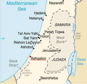
| Description | Ashkelon on the map of Israel | |||
| Date | ||||
| Source | Image:Is-map.PNG | |||
| Author | PeteCS | |||
| Permission (Reusing this file) |
|

File history
Click on a date/time to view the file as it appeared at that time.
| Date/Time | Thumbnail | Dimensions | User | Comment | |
|---|---|---|---|---|---|
| current | 09:42, 18 February 2007 | | 285 × 275 (17 KB) | PeteCS | {{Information |Description=Ashkelon on the map of Israel |Source=Image:Is-map.PNG |Date=18-02-2007 |Author=PeteCS |Permission={{PD-USGov-CIA-WF}} |other_versions=jiné verze }} Category:Ashkelon |
File usage
The following page uses this file:
Global file usage
The following other wikis use this file:
- Usage on cs.wikipedia.org
- Usage on id.wikipedia.org
- Usage on it.wikipedia.org
- Usage on ja.wikipedia.org
- Usage on so.wikipedia.org