
File:Andreanof Map.jpg
No higher resolution available.
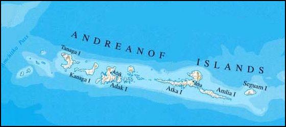
Andreanof_Map.jpg (560 × 249 pixels, file size: 24 KB, MIME type: image/jpeg)
Summary
| Description |
Deutsch: Karte der Andreanof Islands, Alaska |
| Date | |
| Source | http://www.lib.utexas.edu/maps/united_states/united_states_wall_2002_ak.jpg, cropepd |
| Author | nationalatlas.gov/U.S. Geological Survey, edited by Ulrich Kaden |
Licensing
This image is in the public domain in the United States because it only contains materials that originally came from the United States Geological Survey, an agency of the United States Department of the Interior. For more information, see the official USGS copyright policy.
|
File history
Click on a date/time to view the file as it appeared at that time.
| Date/Time | Thumbnail | Dimensions | User | Comment | |
|---|---|---|---|---|---|
| current | 15:37, 13 February 2009 | | 560 × 249 (24 KB) | Ulrich Kaden | {{Information |Description={{en|1=Map of the Andreanof Islands}} {{de|1=Karte der Andreanof Islands}} |Source=http://www.lib.utexas.edu/maps/united_states/united_states_wall_2002_ak.jpg |Author=University of Texas / Own Work |Date=2009 |Permission= |other |
File usage
The following page uses this file:
Global file usage
The following other wikis use this file:
- Usage on ar.wikipedia.org
- Usage on ast.wikipedia.org
- Usage on be.wikipedia.org
- Usage on ca.wikipedia.org
- Usage on ceb.wikipedia.org
- Usage on de.wikipedia.org
- Usage on el.wikipedia.org
- Usage on en.wikipedia.org
- Usage on es.wikipedia.org
- Usage on fi.wikipedia.org
- Usage on gl.wikipedia.org
- Usage on it.wikipedia.org
- Usage on ka.wikipedia.org
- Usage on ko.wikipedia.org
- Usage on no.wikipedia.org
- Usage on uk.wikipedia.org
- Usage on www.wikidata.org
- Usage on zh.wikipedia.org